What is Ethics
A branch of philosophy that deals with the nature of right and wrong. Theory and standards that inform one’s moral practice.
- Ethics and legality are not synonymous
- Laws society has constructed may be informed by ethics
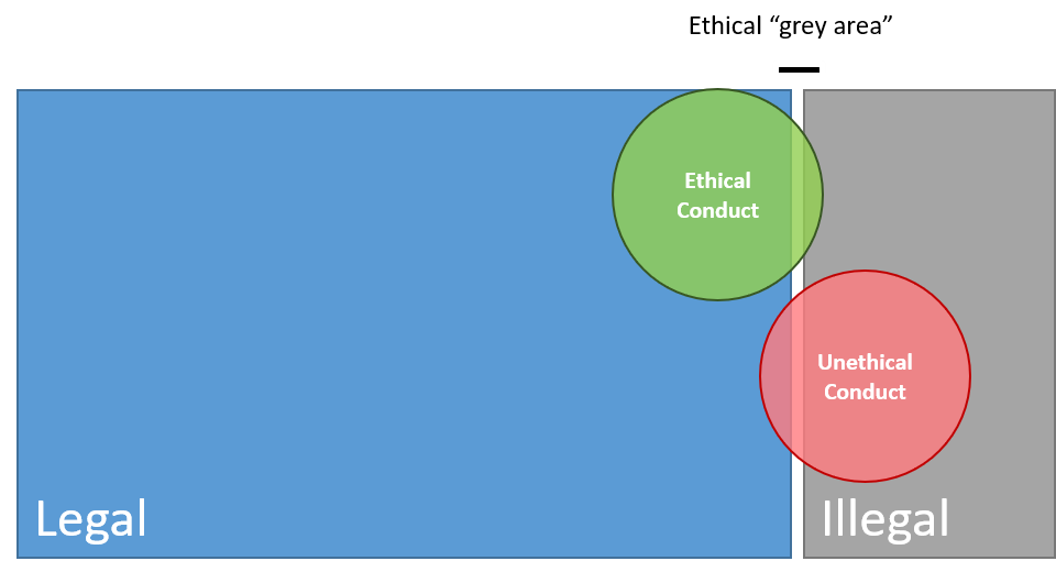
Ethics vs. Legality

Legal but Unethical
Ethical but Illegal
Data Privacy and Security
Organizations have guidelines surrounding exposure of information.
- Public health agencies don’t release information about individuals
- Stats Canada masks census blocks with low response rates
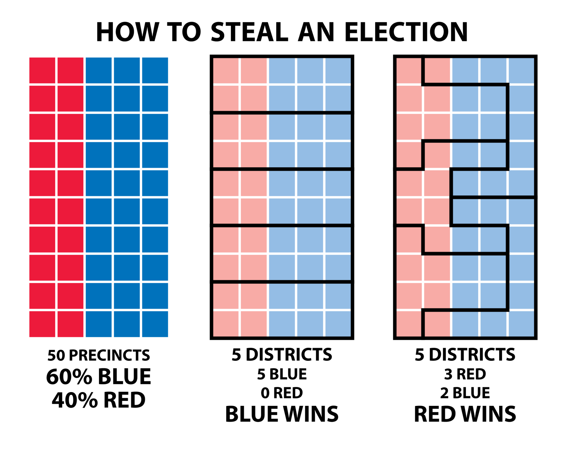
The Power of a Line
Borders are often arbitrary and modifiable.
- Think back to the modifiable areal unit problem
- The decisions of a few can impact many
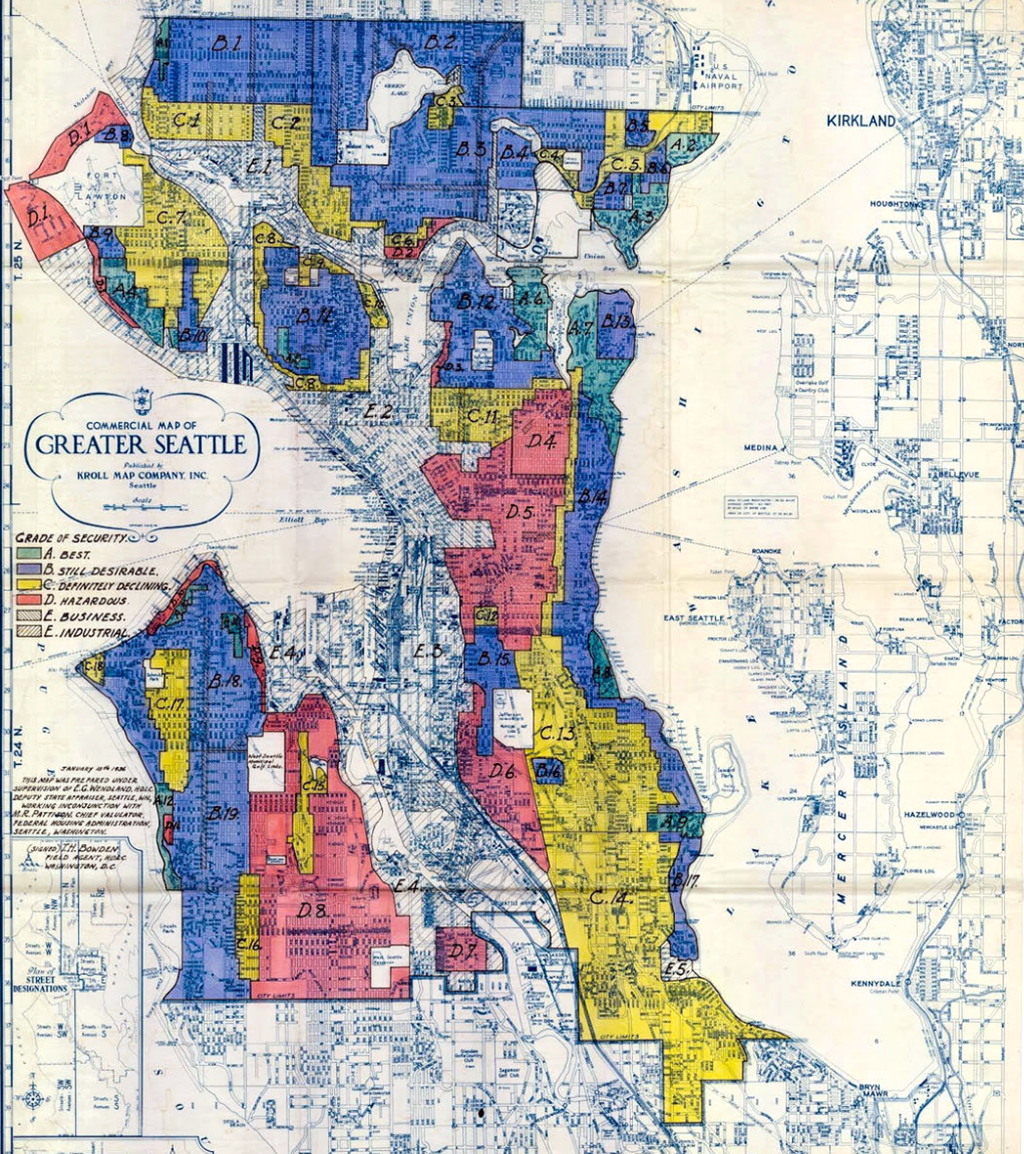
Redlining
The systematic denial of services to marginalized groups by governments and banks used it to segregate communities
- Direct impact on transfer of inter-generational wealth
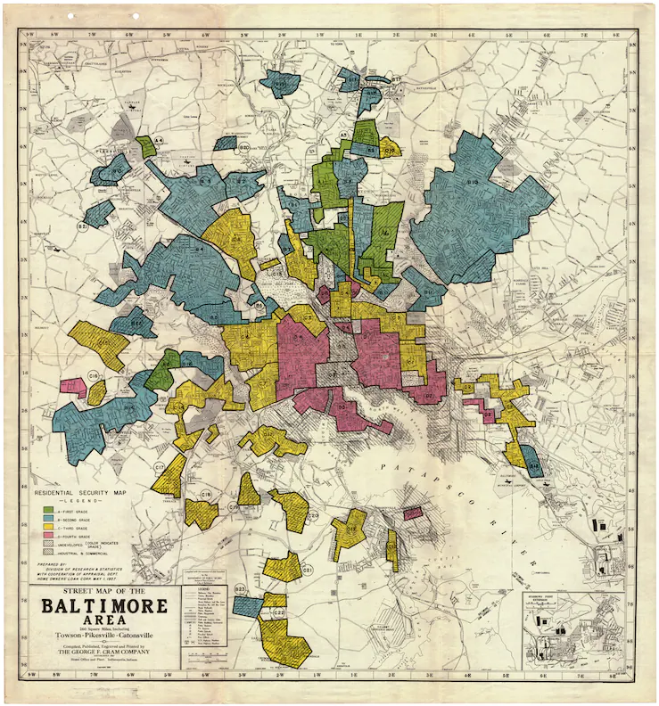
Redlining
For much of the 20th century, redlining was legal and wide spread across North American cities.
- More researched in the US
- Important to note it occurred in Canada as well
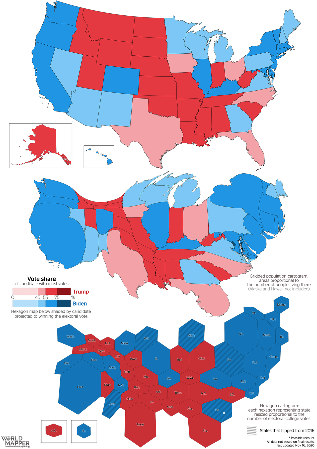
All Maps Lie
Sometimes the lies are intentional.
- Maps can be crafted to sway public opinion and influence political outcomes
- This is a serious ethical issue
All Maps Lie
Sometimes the lies are careless oversights.
- Different projections cause areas to be different sizes
- May intention of the map maker
- Nonetheless it will influence the way people think

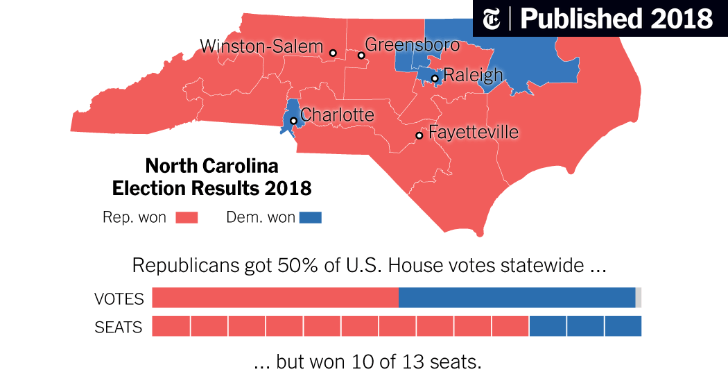
All Maps Lie
Sometimes the lack of context is the issue.
- Map over-represents republican votes
- It may not be an intentional choice
- Nonetheless it influences the way people think
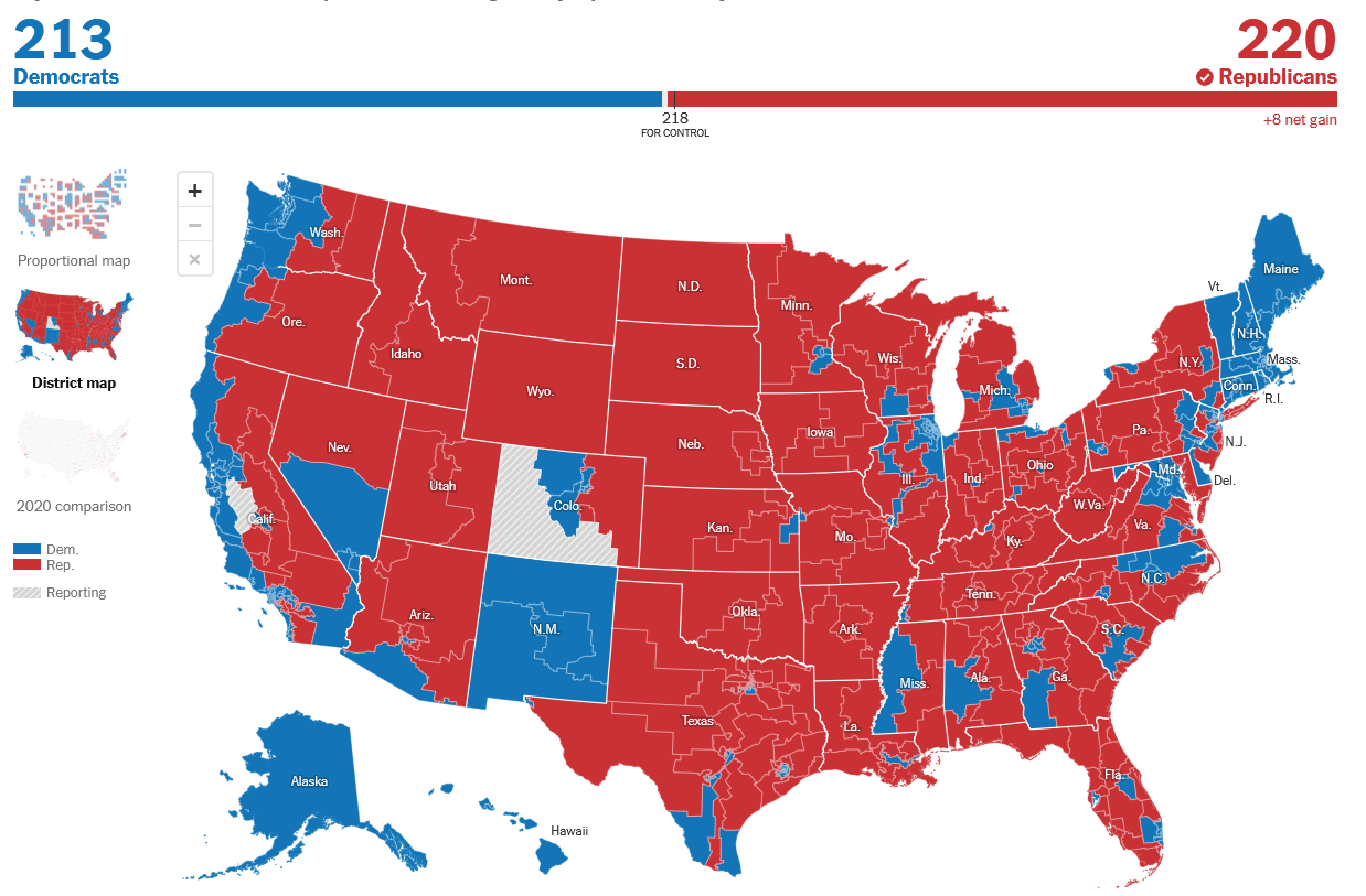
US House of Representatives 2022 Election
All Maps Lie
There are strategies to correct these issues
- Adjust the map area to give more context
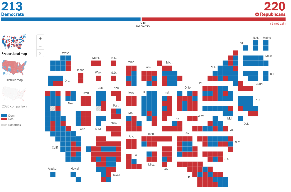
US House of Representatives 2022 Election with Equally Sized Districts
All Maps Lie
There are strategies to correct these issues
- Adjust the map area to give more context
- Cartograms: Sacrifice spatial accuracy to emphasize other attributes
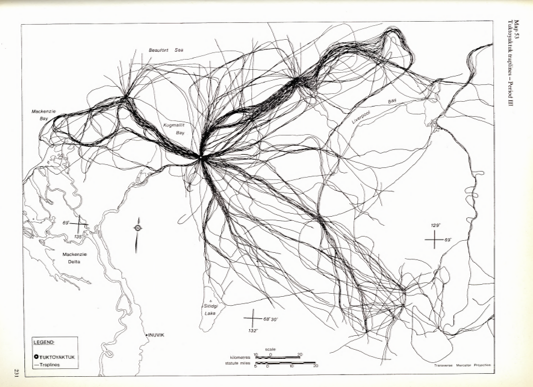
Inuit Land Use and Occupancy
Participatory GIS to safeguard Inuit rights to Arctic lands and waters.
- Inuit People became increasingly concerned about resource extraction projects
- Commissioned a study on land use and occupancy that was instrumental in the establishment of Nunavut

Inuit Land Use and Occupancy
No references to published work or other secondary sources of information:
- Existing maps and information had significant colonial bias
- 100 % Original Data collection from Inuit Sources