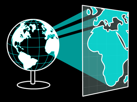
Projected Coordinate Systems
A map projection is a transformation applied to a geographic coordinate system (GCS).
- Converts from 3D coordinates (Lat/Lon) to 2D coordinates (meters)
- Why does this work?
- GCS is 3D coordinate system, but only locations on the surface of the “Earth”
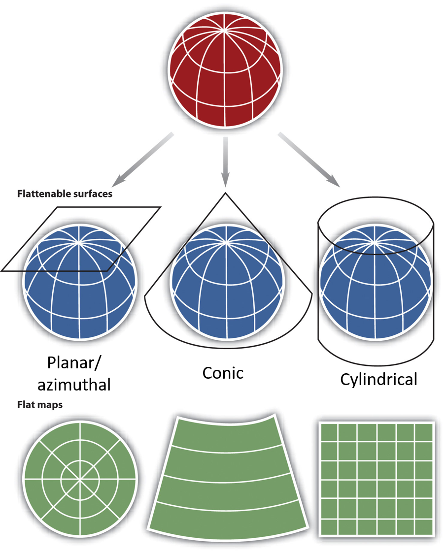
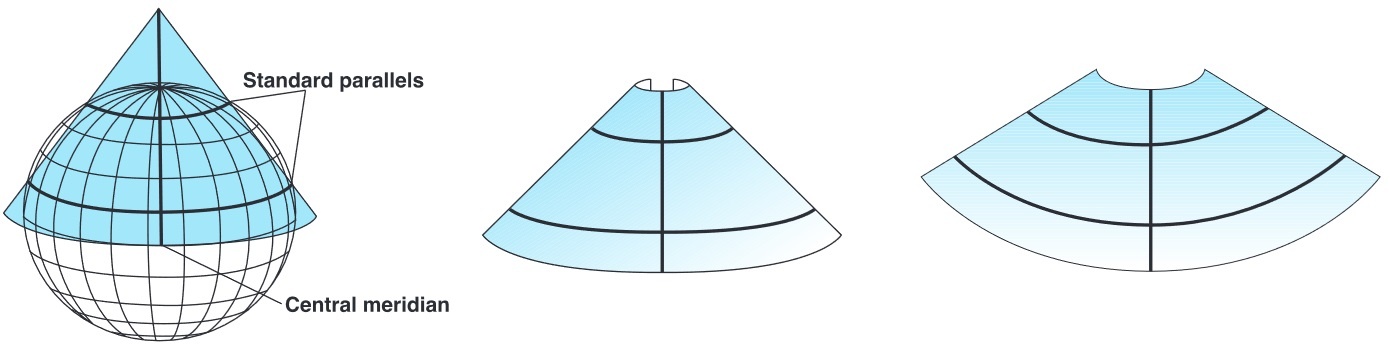
Projection Methods
Three main ways to project the spheroid onto a plane.
- Planar: A plane is referenced to “Earth’s” surface
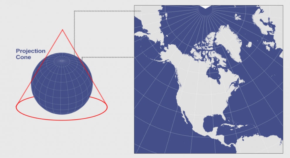
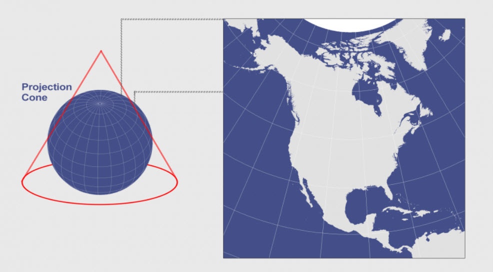
- Conic: A cone is referenced to “Earth’s” surface
- Must be cut to flatten
- Cylindrical: A cylinder is referenced to “Earth’s” surface
- Must be cut to flatten
Projection Methods
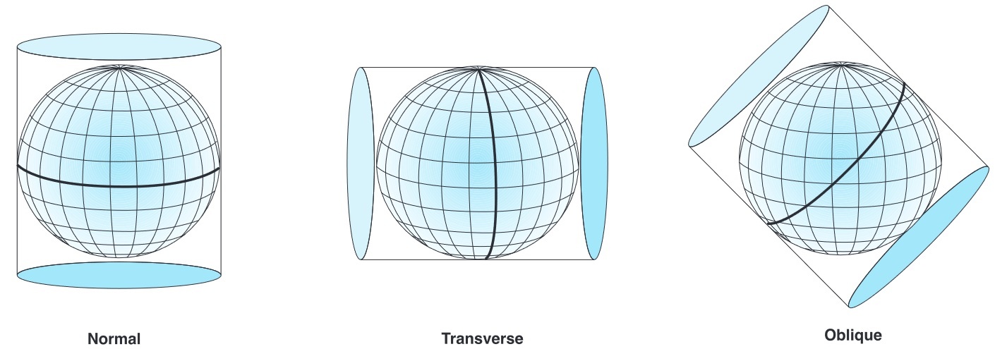
How to reference the influences how the map is distorted.
- Tangent: projections touch the surface at one point or line
- Point for planar, line for conic and cylindrical
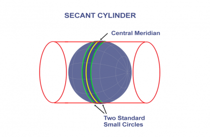
- Secant: when projections touch the surface along two lines
- Helps minimize reduce distortion
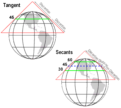
Only locations without distortion
Planar Projections
Planar projections are the simplest approach.
- Limited applicability, typically used for polar regions
- Sometimes also called azimuthal or zenith projections
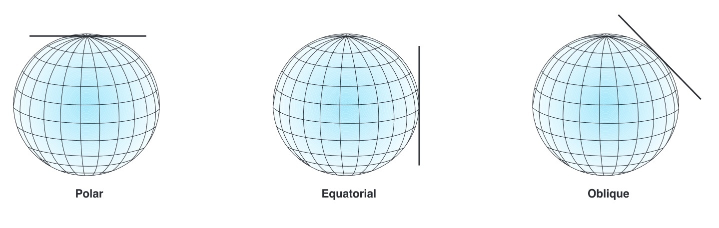
Planar Projections
The Polar Azimuthal projection, tangent to the north pole.
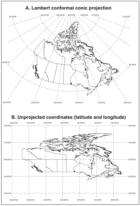
Conic Projections
Conic projections are a great option for the mid-latitudes.
One central meridian
One or two standard parallel(s)
Only work for one hemisphere at a time
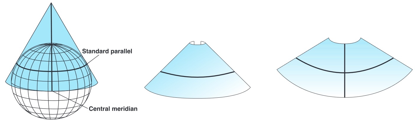
Conic Projections
The BC Environment Albers projection, secant to 50° N and 58° N, central meridian 126° W.
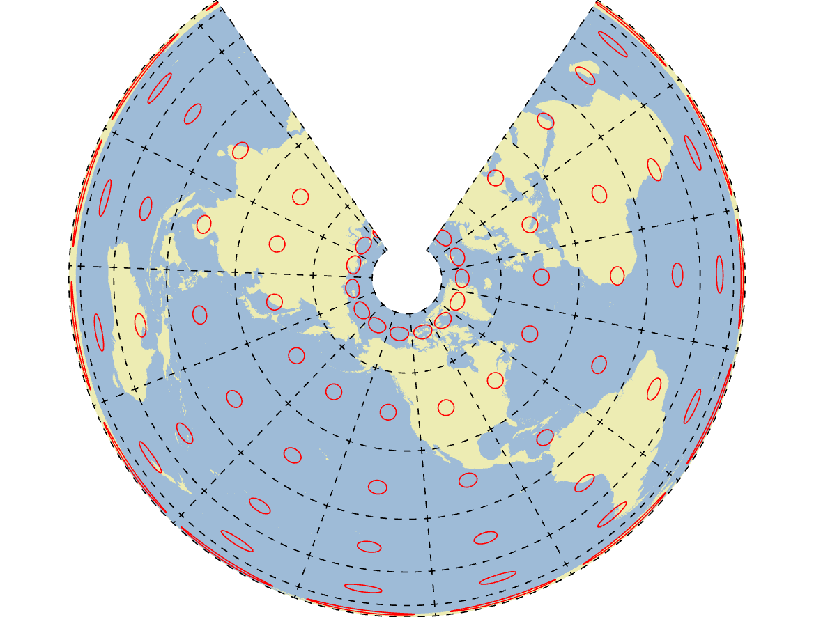
Conic Projections
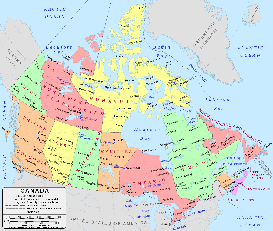
Canada Lambert Conformal Conic
Cylindrical Projections
The only method that works (well) for displaying the full Earth.
Cylindrical Projections
Mercator projection: tangent to 0° N and, central meridian 0° W.
Cylindrical Projections
Transverse cylinders projections are also frequently used.
- Minimize distortion near secant lines
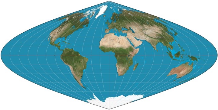
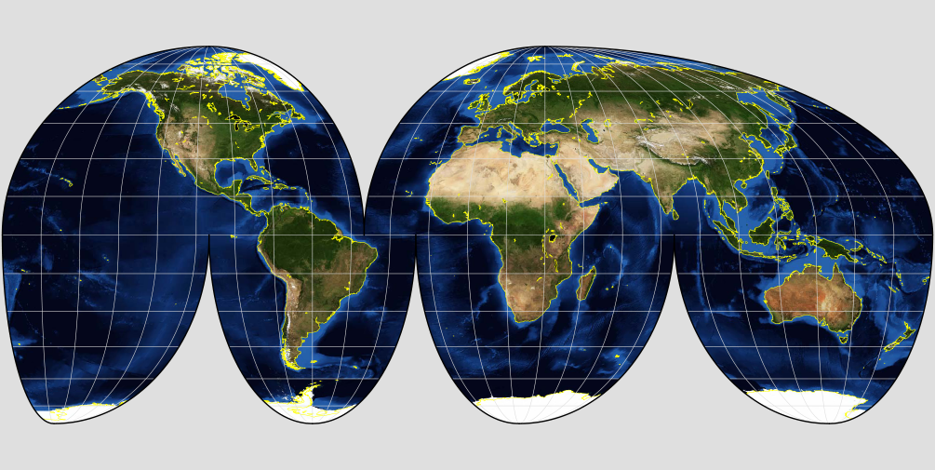
Pseudocylindrical Projections
Special applications, more complex transformations.
Used less frequently, won’t be used in lab.
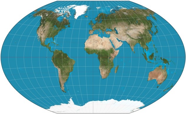
Tearing
All projections require tearing, some projections have more than others.
Shearing
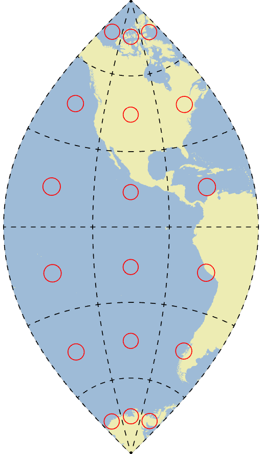
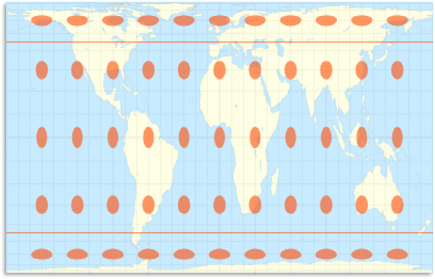
Shapes and angles are contorted by some, but not all projections.
- Gall Peters is a common alternative to the Mercator
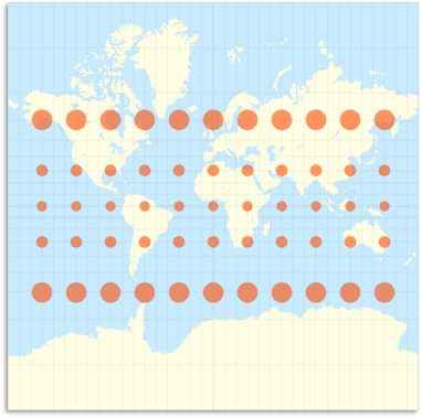
Compression
Areas can be “inflated” or “deflated” some, but not all projections.
- Serious issues when you calculate statistics dependent upon area!
- Population density is a good example
- You will get experience with this in Lab
Compression
Areas can be “inflated” or “deflated” some, but not all projections.
- Serious issues when you calculate statistics dependent upon area!
- Population density is a good example
- You will get experience with this in Lab
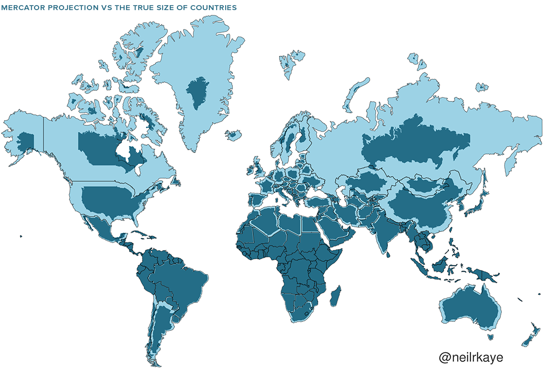
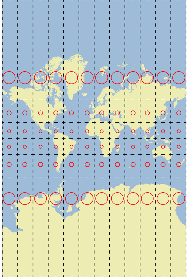
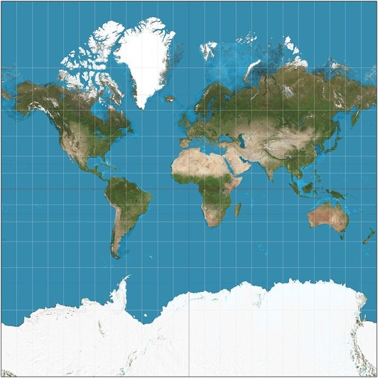
Conformal Projections
Designed to maintain the shapes/angles across the map.
- Mercator is a good example
- It maintains shape/angles, useful for navigation
- To maintain shape globally, it must severely distort area
- Scale changes across map, bad for measuring distance/area
Conformal Projections
Designed to maintain the shapes/angles across the map.
- Lambert Conformal Conic
- Area distortions are less drastic
- A conic projection using secant lines
- However, the area calculations are not true to reality
- Area distortions are less drastic
Universal Transverse Mercator (UTM)
Globe is divided into 60 strips 6° wide, spanning 80°N to 80°S.
- Special type of conformal projection
- Only used for “small” areas
- Minimal distortion within zones
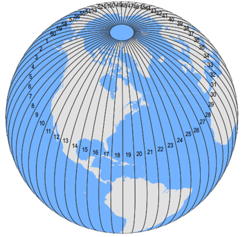
Universal Transverse Mercator (UTM)
Globe is divided into 60 strips 6° wide, spanning 80°N to 80°S.
- Special type of conformal projection
- Only used for “small” areas
- Minimal distortion within zones
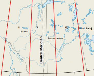
UTM Zones
Vancouver is in UTM Zone 10N.
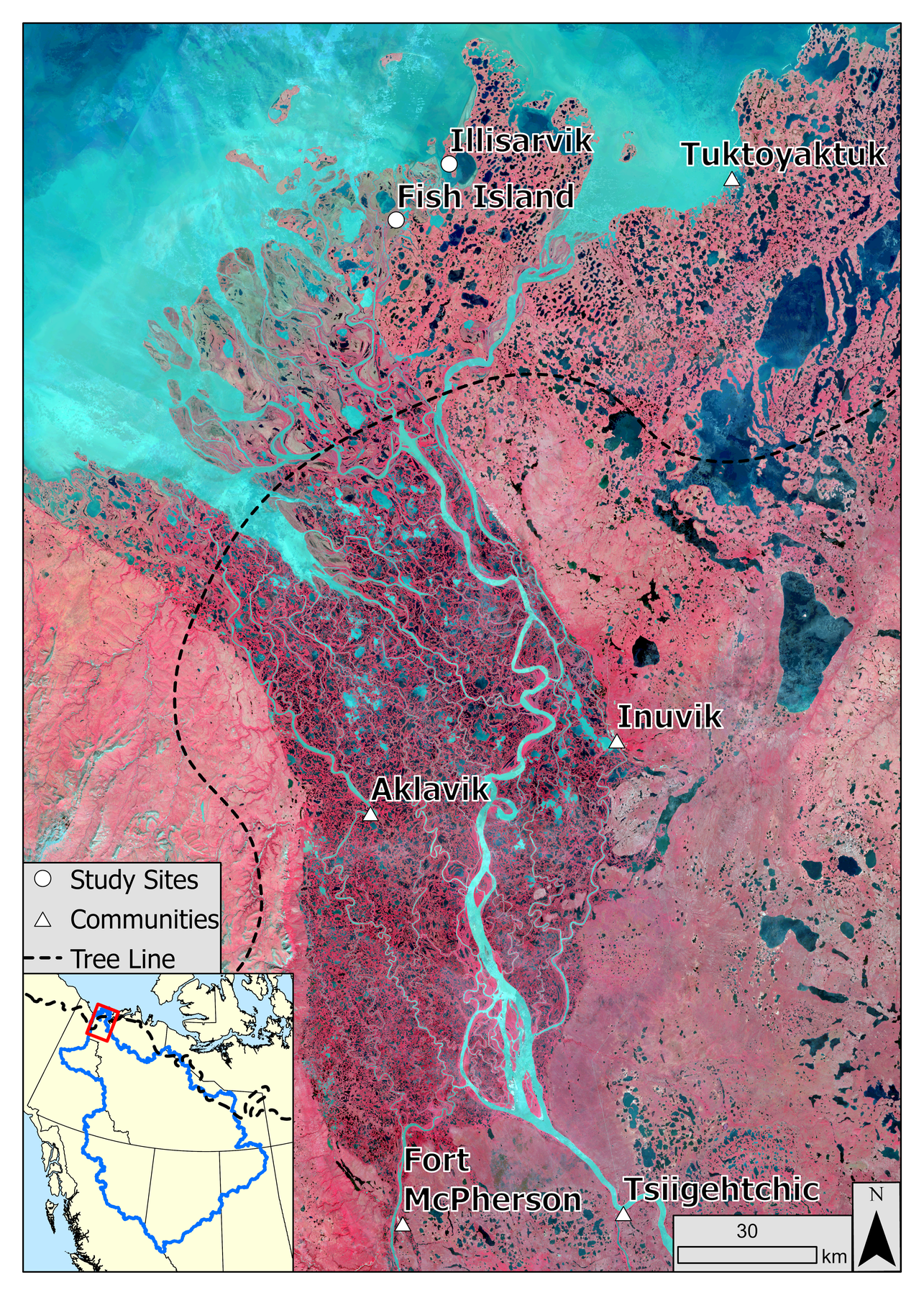
Mackenzie Delta, UTM Zone 8N
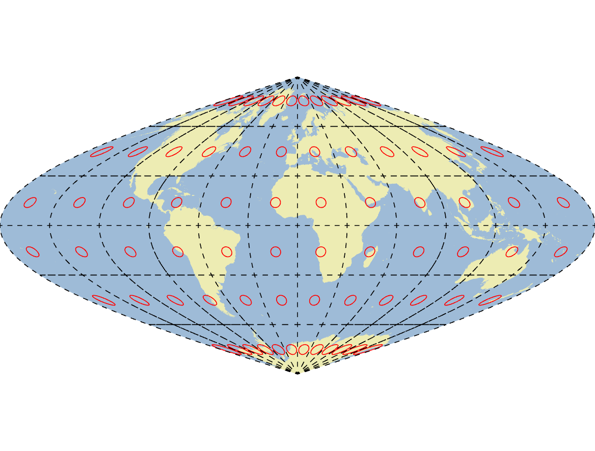
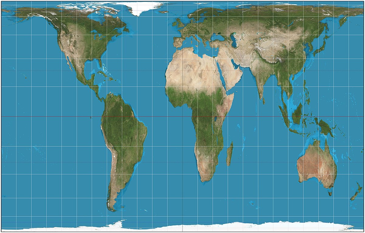
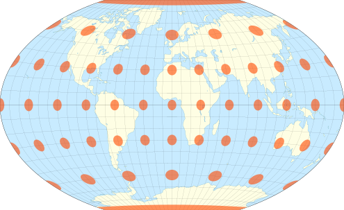
Equal Area Projections
Designed to preserves area, useful where area must be preserved for land surface analysis.
- Gall Peters projection
- Maintains area, can be used to calculate population density
- Angles & shapes are deformed so it “looks” weird
Equal Area Projections
Designed to preserves area, useful where area must be preserved for land surface analysis.
- The Albers equal area
- Shape distortions are less drastic
- A conic projection using secant lines
- Still visible, especially in the north
- Shape distortions are less drastic
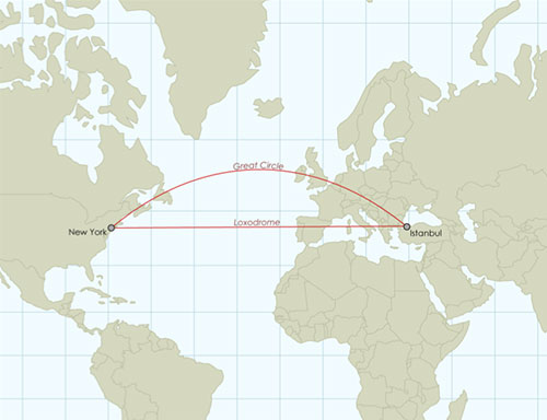
Equidistant/True-Direction Projections
Designed to preserves distance/direction.
- Cannot be preserved globally, only specific locations
- e.g. lines radiating from center of an azimuthal projection
- Gives a “great circle” route
- Shortest line between two locations
Equidistant/True-Direction Projections
Designed to preserves distance/direction.
- Cannot be preserved globally, only specific locations
- e.g. lines radiating from center of an azimuthal projection
- Gives a “great circle” route
- Shortest line between two locations
Compromise Projections
These projections are designed for aesthetics.
Minimize distortion without preserving any one property.
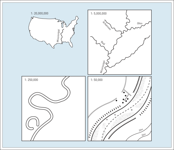
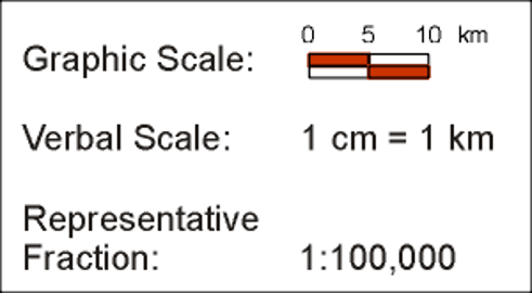
Map Scale
Relationship between distance on a map to distance in the real world.
- How much smaller is a unit on the map than a unit on the earth?
- i.e. 1 cm on the map = 1 km on the Earth
- Graphic, verbal, or representative fraction
Map Scale
Small Scale: Zoomed out, large area, more general, less detail.
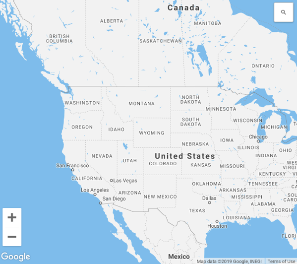
Large Scale: Zoomed in, small area, more detail, less general.
Map Scale
Small Scale 1:10,000,000
1/10,000,000 = 0.0000001
Large Scale 1:1,000
1/1,000 = 0.001
Map Scale
All maps require simplification of real world features. The degree of simplification is a function of the scale.
- Smaller scale maps require more generalization.
- Larger scale maps can include more detail.