GIS has become a powerful, widely used tool for GIS in recent decades.
Proprietary GIS Software
GIS is very much rooted in capitalism and the capitalist enterprise. Consequently many of the initial developments in GIS were by for profit companies.
ESRI is a leading producer of GIS software. They make ArcGIS Pro, the software package we will be working with most in this class.
Proprietary GIS Software
Proprietary software requires a license and restricts access to source code. Common examples include:
Operating Systems: Windows OS, Mac OS, IOS
Programming Languages: MATLAB, VBScript
Software Packages: Microsoft Office (Word, Excel, Power Point etc.), Adobe Illustrator, IOS, ArcMap
Proprietary software licenses are often expensive. They pose a barrier to access many users.
Once you learn the basic, you can move on to cheaper options
Open Source GIS
Open Source software is free to use, published under an open copyright license. Users have the right to view, edit, and distribute the source code. Common examples include:
Open Street Maps is a freely available public database of geospatial information.
Programmatic GIS
Python, JavaScript, R, etc. can be used to for GSI.
I created this webmap using JavaScript.
I’ll talk a bit more about these methods later on in the term.
Fremium Services
Companies like mapbox and google provide some geospatial services that are “free” to a point.
Google earth engine provides its cloud based computational capabilities to non-commercial users free of charge.
Tophat Question 1
Which term describes freely accessible software that can be accessed, edited, and distributed by anyone?
Proprietary
Open Source
Fremium
Tophat Question 2
ArcGIS Pro is a proprietary software package. It is created and maintained by a private company and requires users to purchase a license to access it.
True
False
Countering Colonialism
The lands that comprise Canada have histories that stretch back well before the colonial era.
Colonial mapping centered on erasing Indigenous peoples and their histories
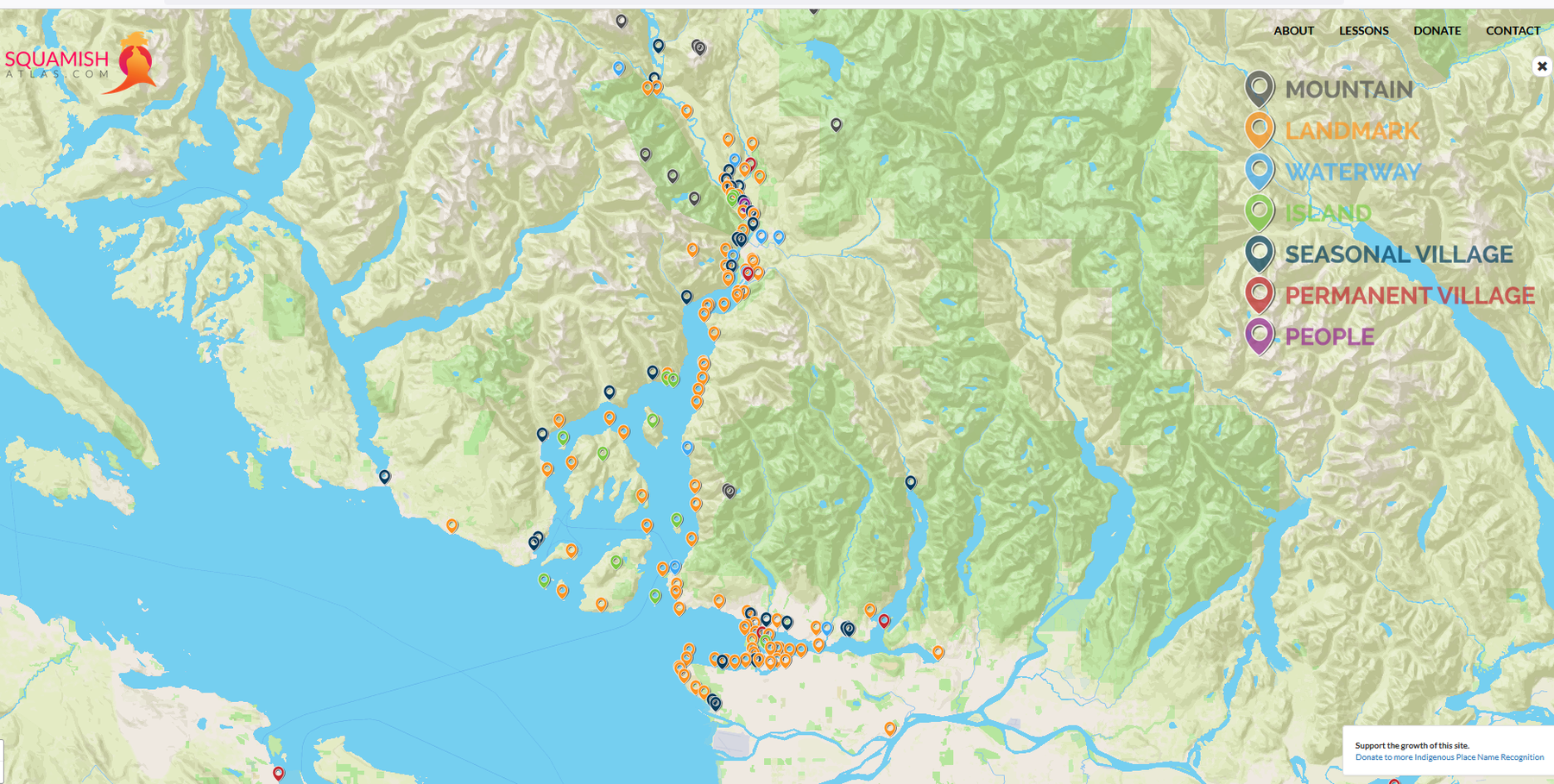
Ch’ich’iyuy: The Twins Skwxwú7mesh name for “The Lions”
Learning Place Names
The Skwxwú7mesh Atlas is a great resource for learning about Skwxwú7mesh Place Names.
The xʷməθkʷəy̓əm nation has put together a great resource for as well!
Tophat Question 3
Historically, many colonial mapping efforts focused on erasing Indigenous identity and territorial claims. However, modern GIS, particularly open source, web based applications can help counter those historic colonial narratives.