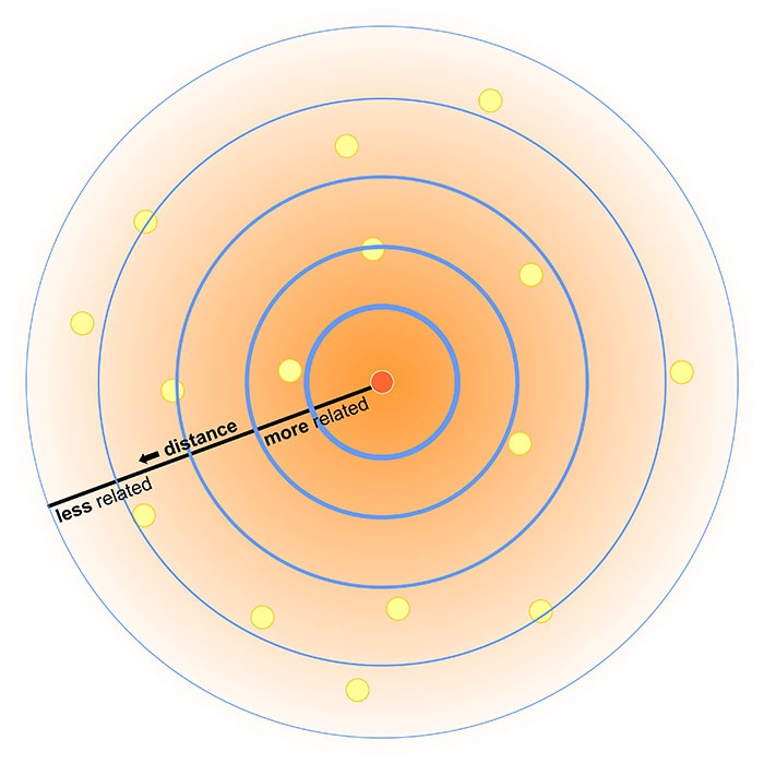
First Law of Geography
“Everything is related to everything else,
but near things are more related than distant things.”
-Waldo Tobler
First Law of Geography
This might seem obvious:
- Students in the same class interact more.
- Orca pods in different areas develop different dialects.
- Hemlocks in BC are more related to each other than to hemlocks in NB.
First Law of Geography
Not a grantee of similarity.
- Vancouver’s average snowfall is < 30 cm/yr
- Grouse Mountain frequently exceeds 9 m/yr
First Law of Geography
What do you have in common with your neighbor?
- Are you in the same city?
- Do you have the same major?
- Are you from the same hometown?
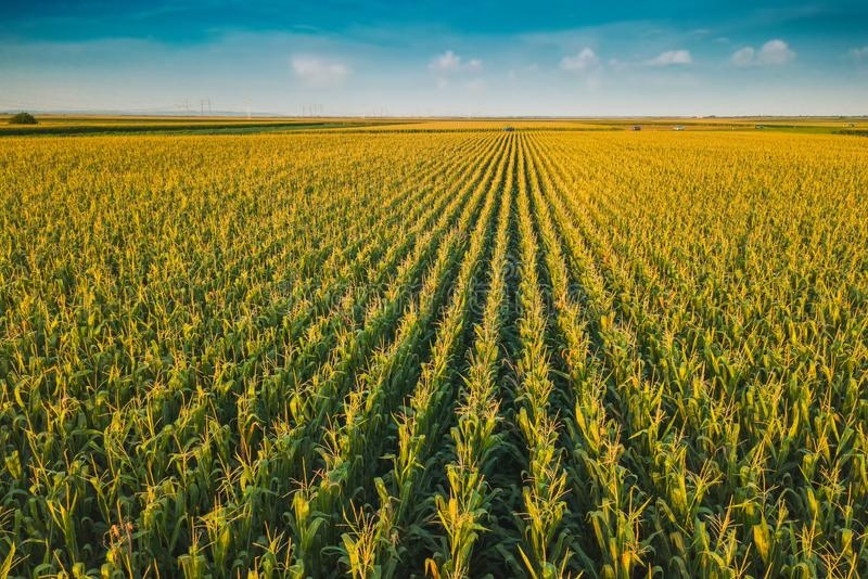
Spatial Homogeneity
Even distribution of discrete objects trough space, or values (qualitative or quantitative) across a continuous field.
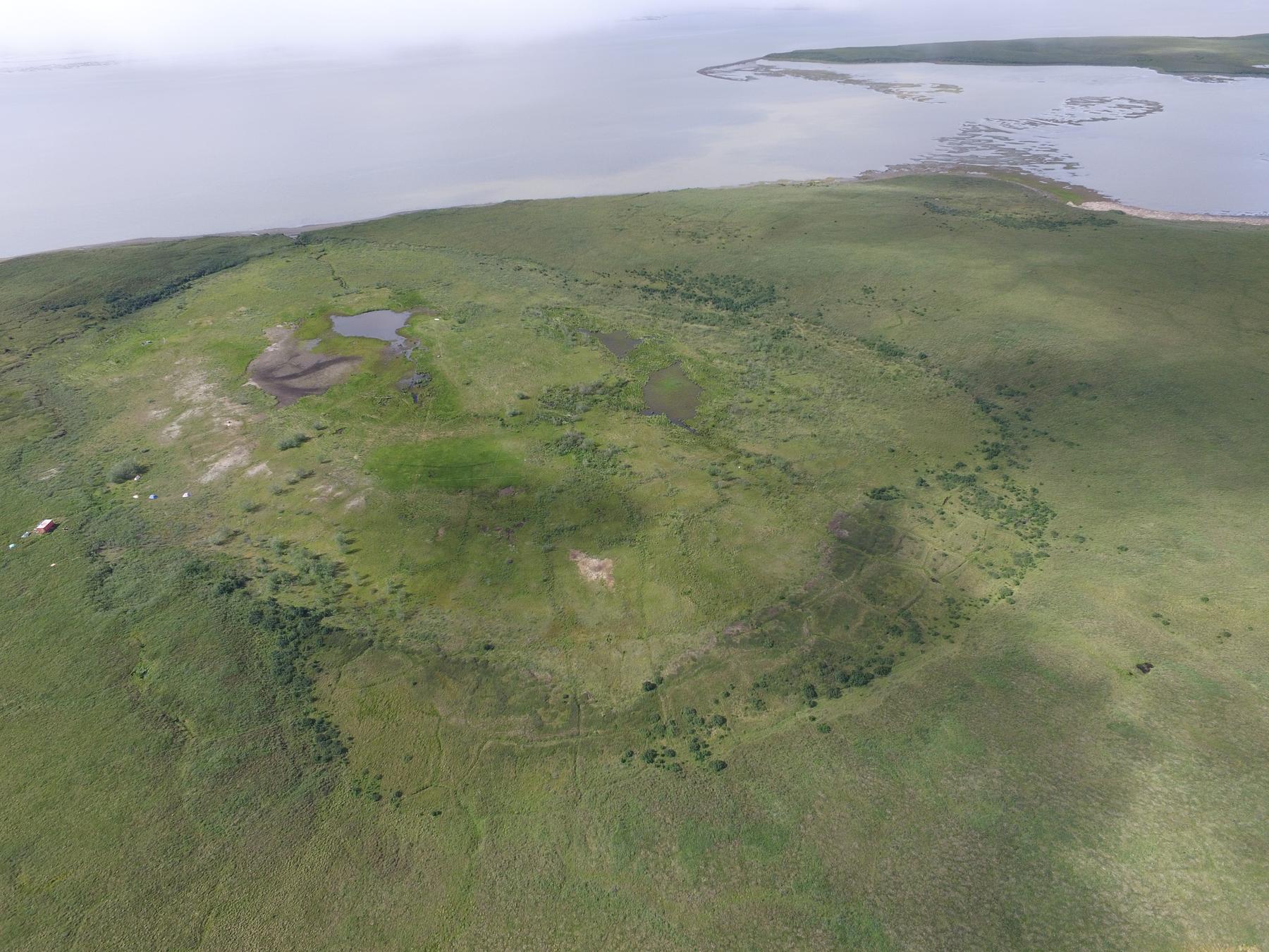
Spatial Heterogeneity
Uneven distribution of discrete objects trough space, or variation of values (qualitative or quantitative) across a continuous field.
- Opposite of Spatial Homogeneity
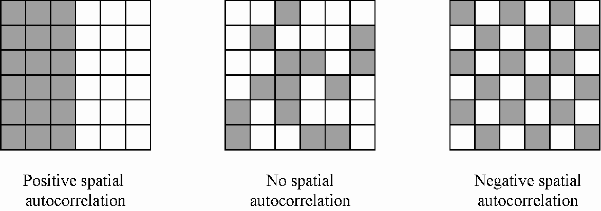
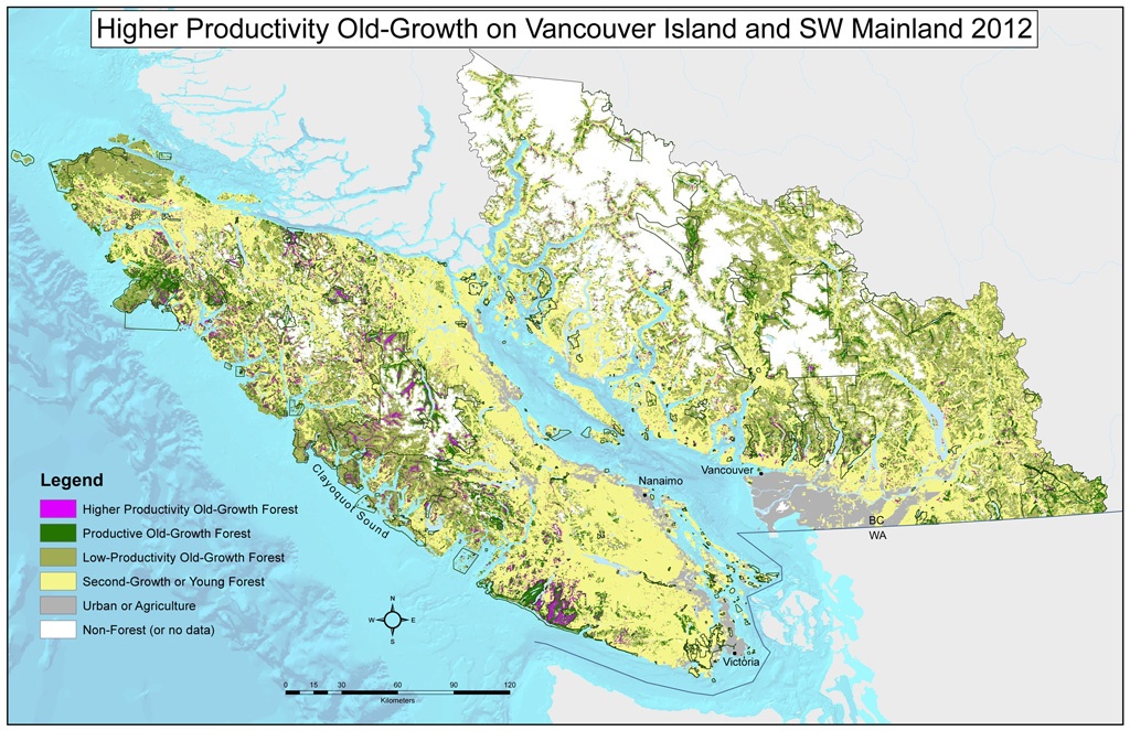
Spatial Autocorrelation
Revisiting Scale
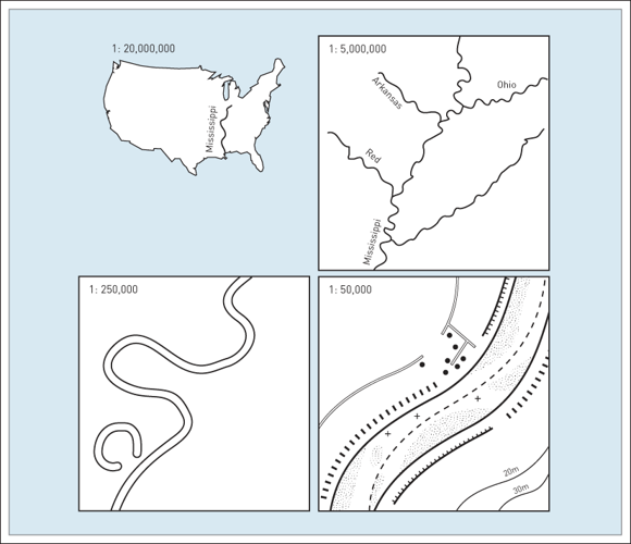
Map scale: ratio of map units to real world units.
- Small Scale: Large area, more generalization, less detail.
- Large Scale: Small area, more detail, less generalization.
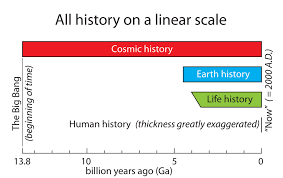
Time Scale
Time is “one dimensional”, but many of the same concepts related to scale apply.
- Just as features are exhibit spatial autocorrelation, they typically exhibit temporal autocorrelation
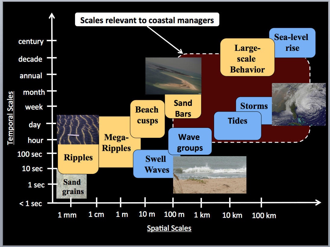
Analysis Scale
Different phenomena operate on different temporal and spatial scales.
- No need to model tornadoes in a global climate model.
- Impractical to map turbulence globally.
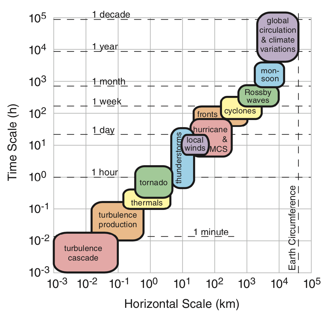
Analysis Scale
Different phenomena operate on different temporal and spatial scales.
- Identify the scale relevant to your analysis.
Map the Forest not the Trees
We don’t need the location of every tree to map a forest.
- Use average presence of trees over a larger area
- Group by dominant species or category
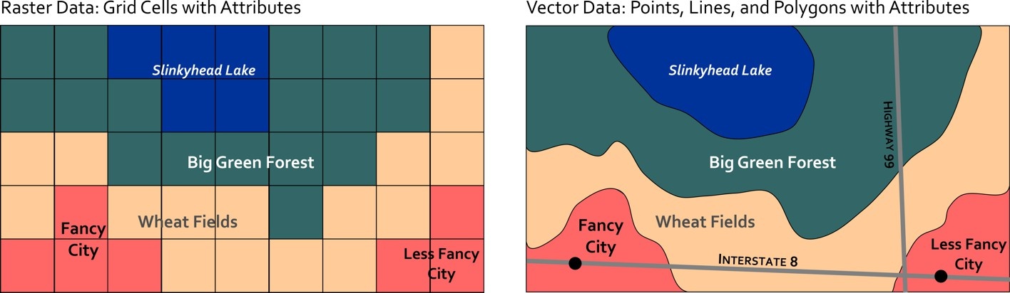
Spatial Data Models
We can exploit spatial autocorrelation to simplify data representation.
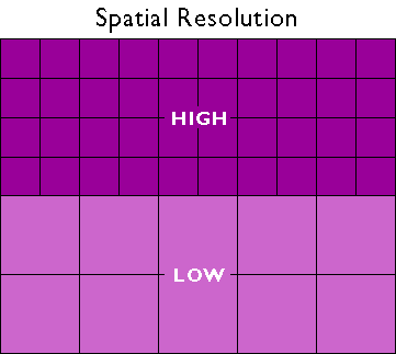
Spatial Resolution
Relates to the level of spatial detail in a dataset.
- What is the smallest feature that is included in a dataset?
Temporal Resolution
Relates to the level of temporal detail in a dataset.
- Over what time period is the data valid?
- Are there multiple observations?
Scale Dependence
Scale Dependence
Acknowledge heterogeneity where appropriate.
- Large scale maps might need more attention to detail.
- Higher resolution data.
Scale Dependence
Count on spatial autocorrelation
and call a unit homogeneous where appropriate.
- Smaller scale maps can be more generalized.
- Lower resolution data.

Scale Dependence
At even smaller scales, more and more generalization is required.
- Some features become indistinguishable
- Even lower resolution data is sufficient
Spatial Data Models
Raster and vector models are distinct approaches for addressing the same task.