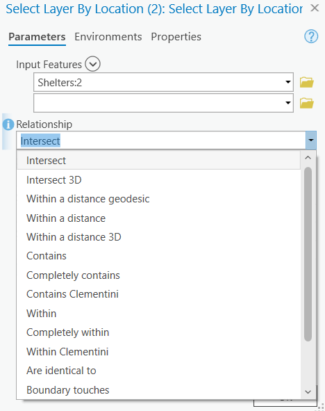
Select by Location
Use to check for spatial relationships such as:
- Containment
- Intersection
- Distance
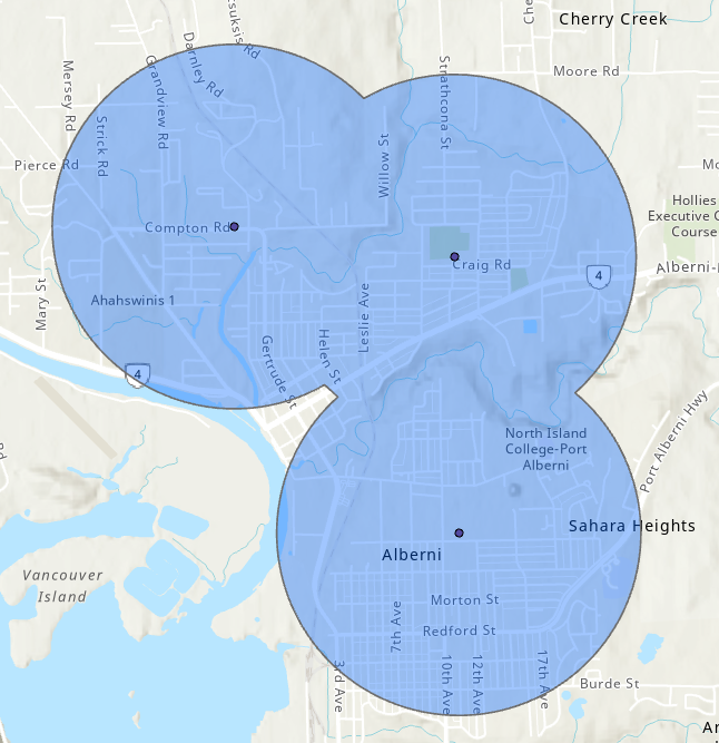
Buffer
Create a new Polygon layer based on distance.
- Buffer points, lines, or polygons using a buffer distance or set a field to specify varriable distance.
- Use the Multiple Ring Buffer tool for multi-criteria buffers.
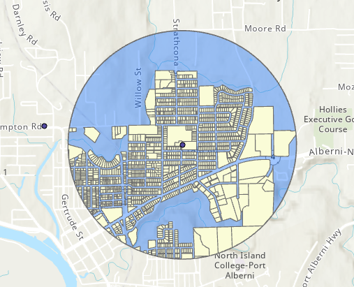
Example From ESRI Docs
Buffer
Create a new Polygon layer based on distance.
- Buffer points, lines, or polygons using a buffer distance or set a field to specify varriable distance.
- Use the Multiple Ring Buffer tool for multi-criteria buffers.
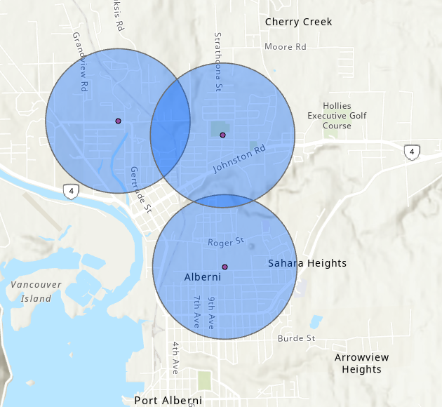
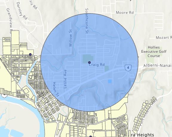
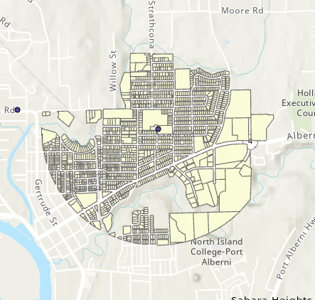
Buffering Tsunami Shelters
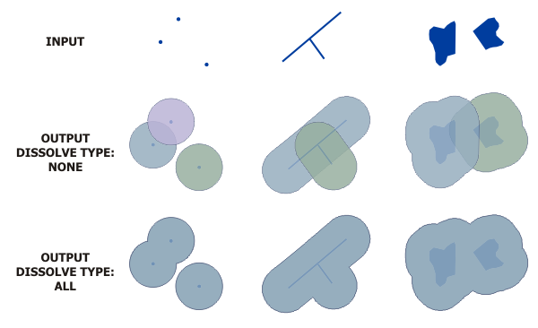
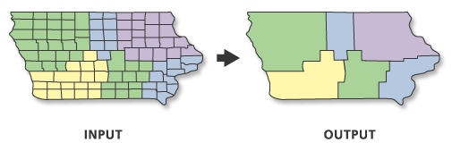
Dissolve
Aggregates features.
- Merges objects completely or by attribute(s).
- Can calculate statistics for aggregated regions.
- Useful if our data is more “complex” than we need it to be.
Example From ESRI Docs
Dissolve
Aggregates features.
- Merges objects completely or by attribute(s).
- Can calculate statistics for aggregated regions.
- Useful if our data is more “complex” than we need it to be.
Dissolve Shelter Buffers
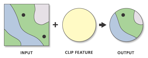
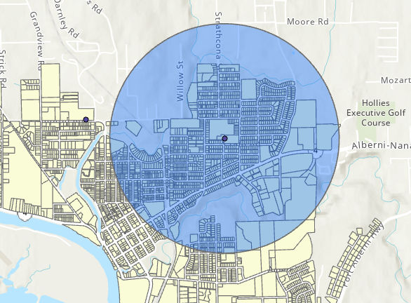
Clip
Cut one layer down to the boundaries of another.
- Useful when we want to focus on a study area
- Does not alter attributes
- Input layer: our data layer
- Clip layer: the study area
Example From ESRI Docs
Clip
Cut one layer down to the boundaries of another.
- Useful when we want to focus on a study area
- Does not alter attributes
- Input layer: our data layer
- Clip layer: the study area
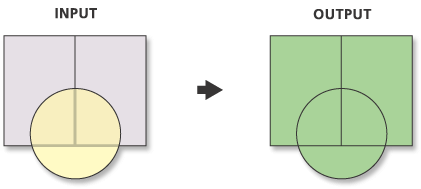
Input
Clip
Cut one layer down to the boundaries of another.
- Useful when we want to focus on a study area
- Does not alter attributes
- Input layer: our data layer
- Clip layer: the study area
Output
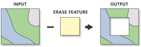
Erase
Remove the area of one layer from another.
- Opposite of the clip tool
- Does not alter attributes
- Useful when we want to discard/exclude an area
Example From ESRI Docs
Erase
Remove the area of one layer from another.
- Opposite of the clip tool
- Does not alter attributes
- Useful when we want to discard/exclude an area
Input
Erase
Remove the area of one layer from another.
- Opposite of the clip tool
- Does not alter attributes
- Useful when we want to discard/exclude an area
Output
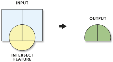
Intersect
Output where layers overlap and combine attributes.
- Can handle more than two layers at once
- Splits features by overlaps and merges attribute tables
- Merge and parse data at the same time
Example From ESRI Docs
Intersect
Output where layers overlap and combine attributes.
- Can handle more than two layers at once
- Splits features by overlaps and merges attribute tables
- Merge and parse data at the same time
Input
Intersect
Output where layers overlap and combine attributes.
- Can handle more than two layers at once
- Splits features by overlaps and merges attribute tables
- Merge and parse data at the same time
Output
Union
Combine multiple polygon layers, split features where they overlap and combine attributes.
- Similar to intersect, but keeps overlapping areas
![]()