History of GIS
Pre-Historic Maps
Many of the first maps are difficult to recognize as such.
- Rock art, pottery, carving, and etchings
- Movement, gestures, & oral traditions
- Paper and Textile maps appeared later
Pre-Historic Maps
Frequently depicted:
- Landscapes
- Hunting Grounds
- Villages
- Agricultural Plots
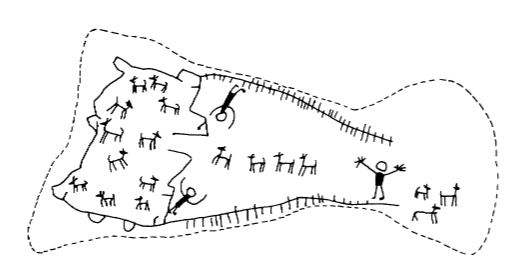
Few Surviving Examples
In many cases we must look to more recent examples.
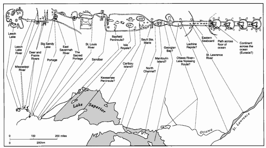
Ojibway birch bark scrolls.
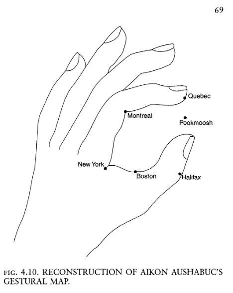
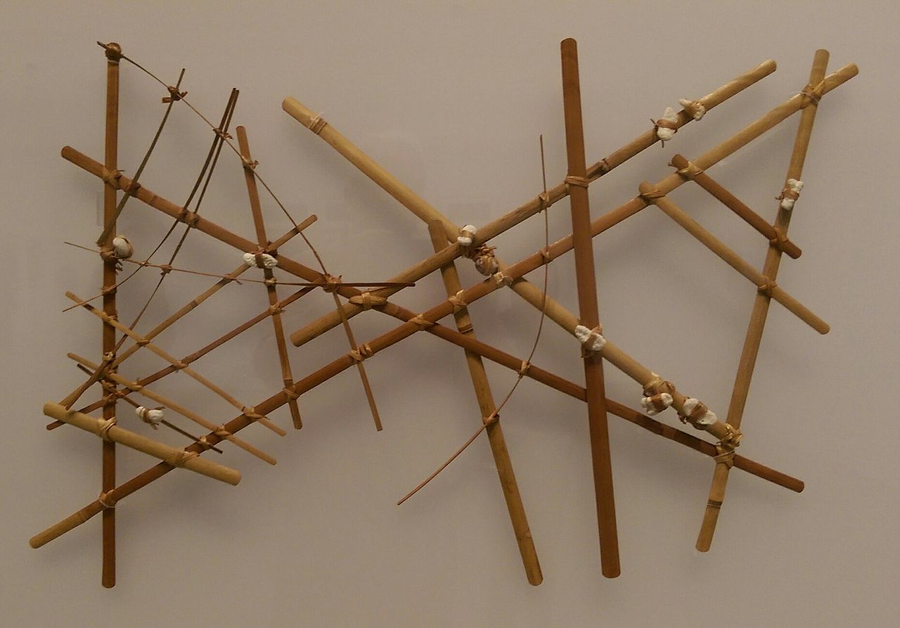
Miꞌkmaq gestural map
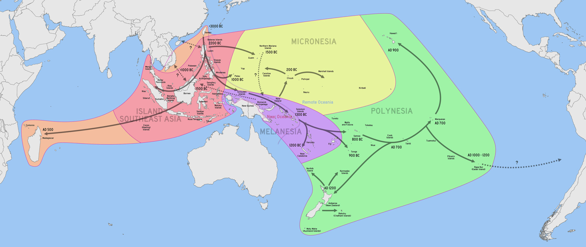
Cartography and Navigation
Austronesian expansion started ~5,000 B.P.
- Crossed oceans reading stars, waves, weather, and wildlife
- Charts, songs, and stories to recorded details
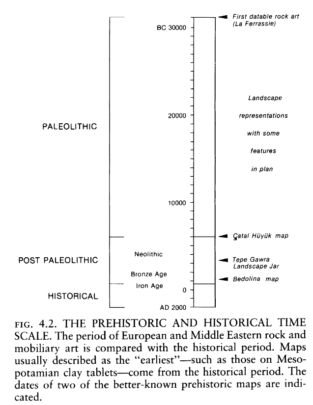
Oldest Known Maps
Landscape around Dyje River, Czechia (26,000 B.P.)
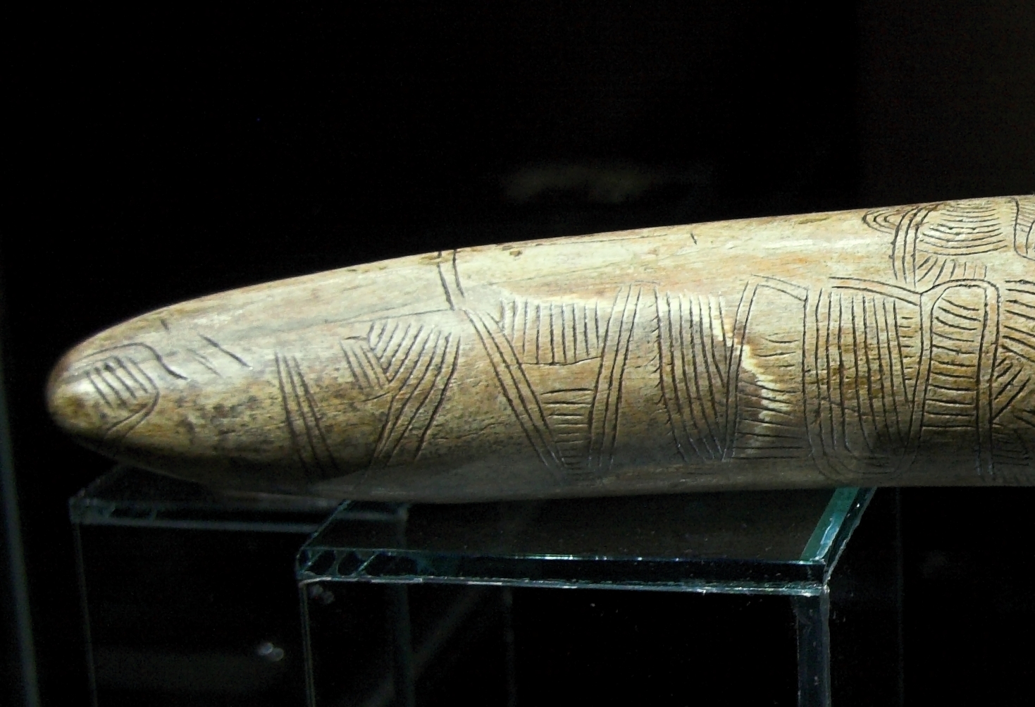
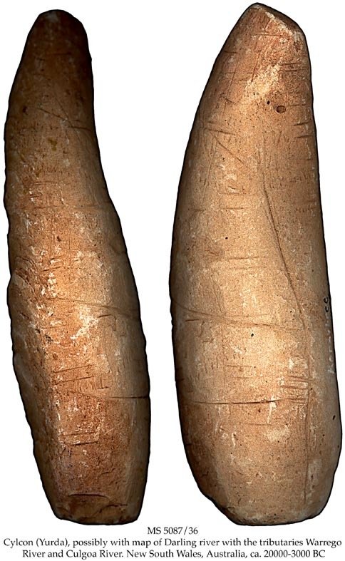
Darling River basin, Australia (~20,000 B.P.)
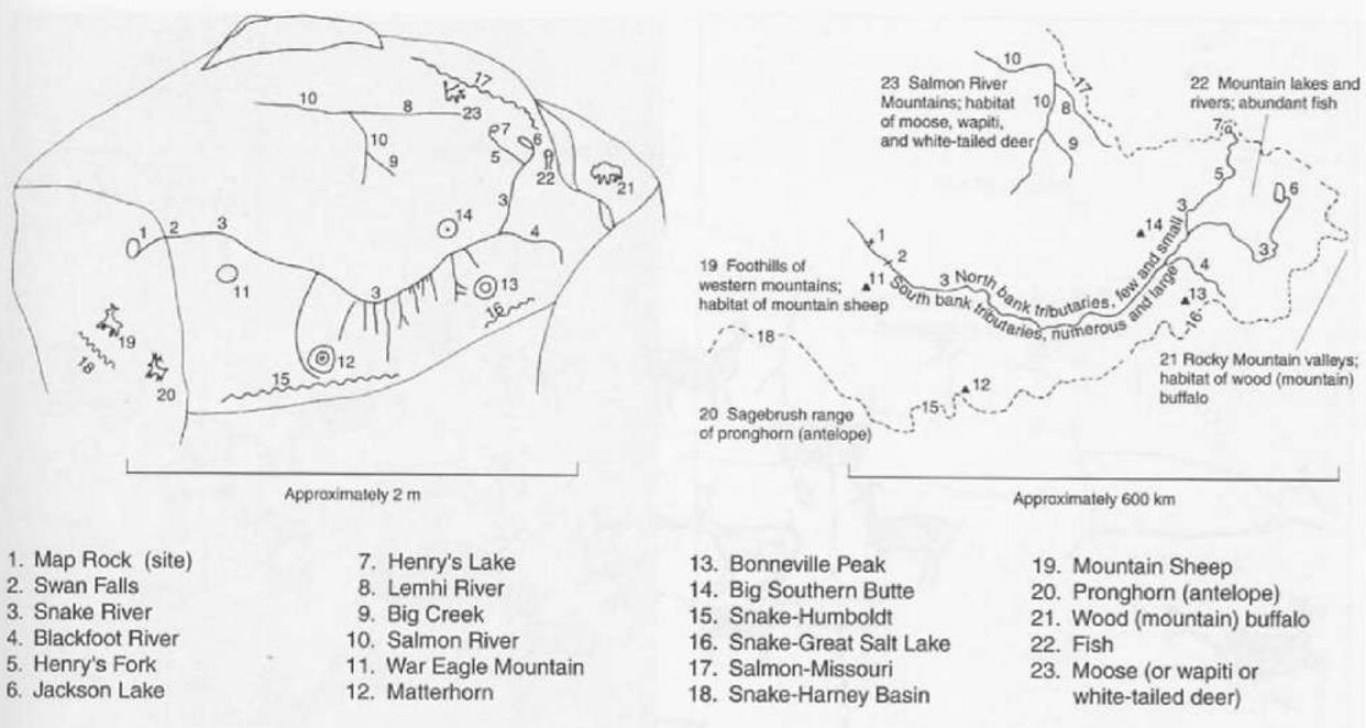
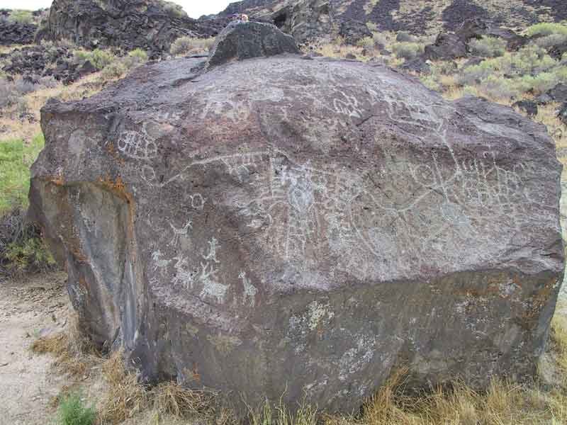
Oldest Known Maps
Map Rock is an engraving of a 600km reach of the Snake River Valley, Idaho (~12,000 B.P.)
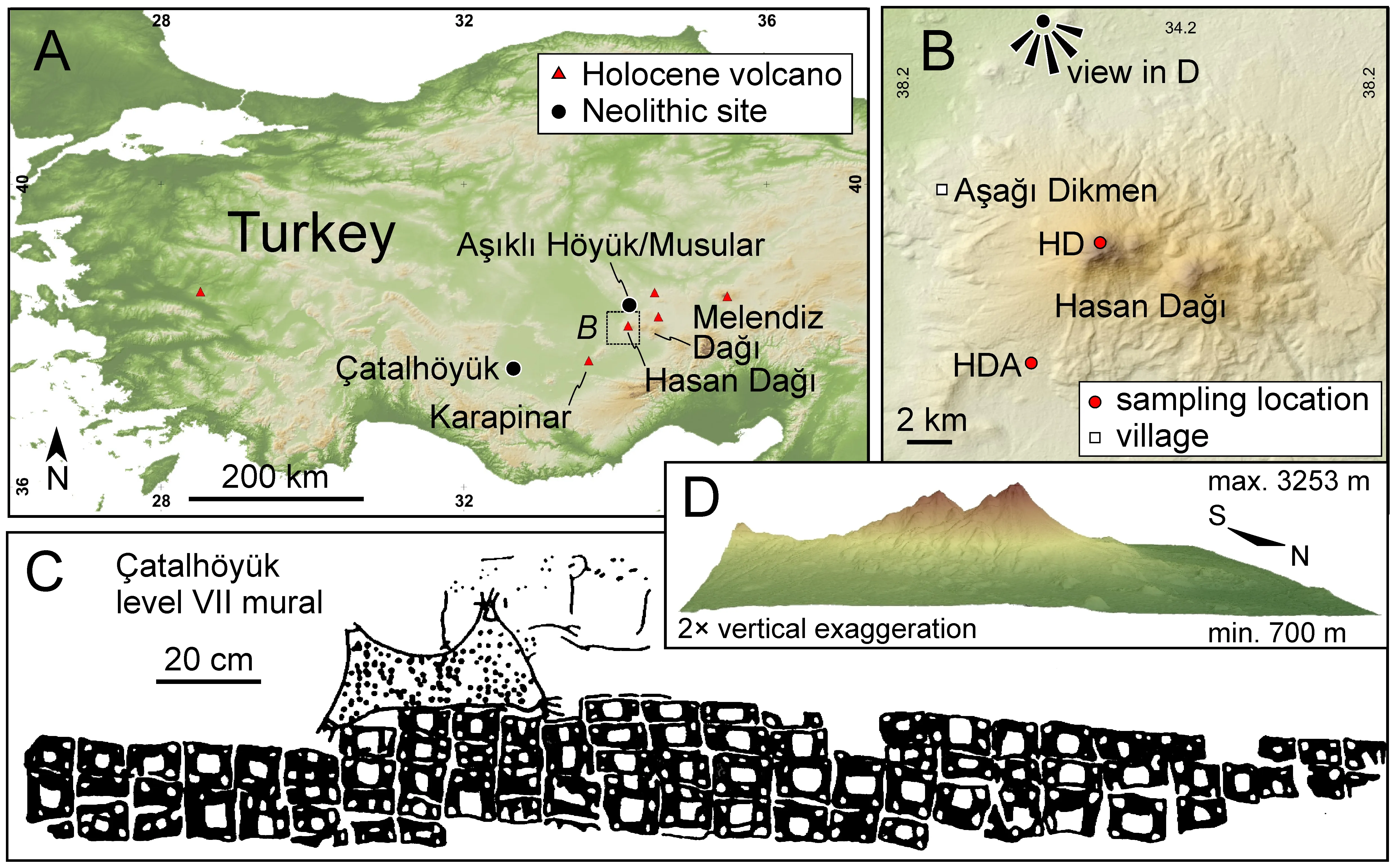
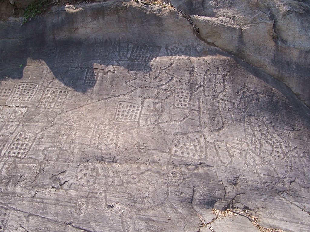
First "Urban" Plans
Çatalhöyük Turkey, 8700 B.P.
Bedolina, Italy 4000 B.P.
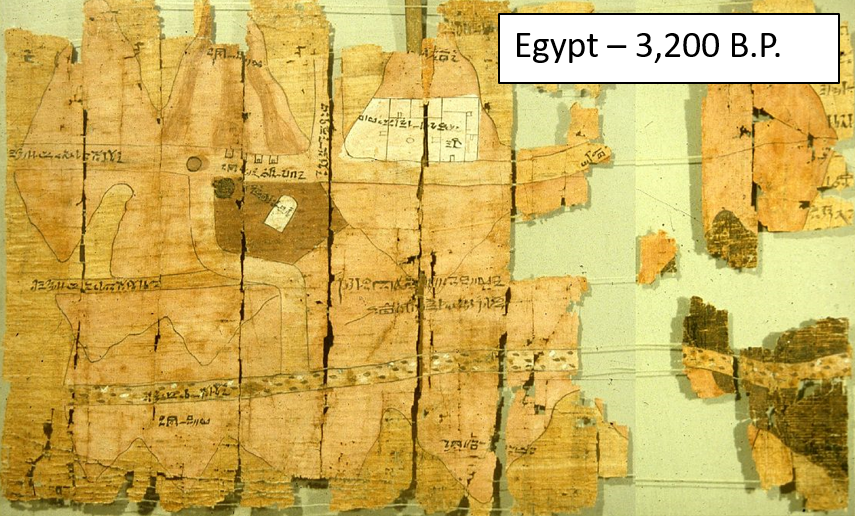
Paper and Textile Maps
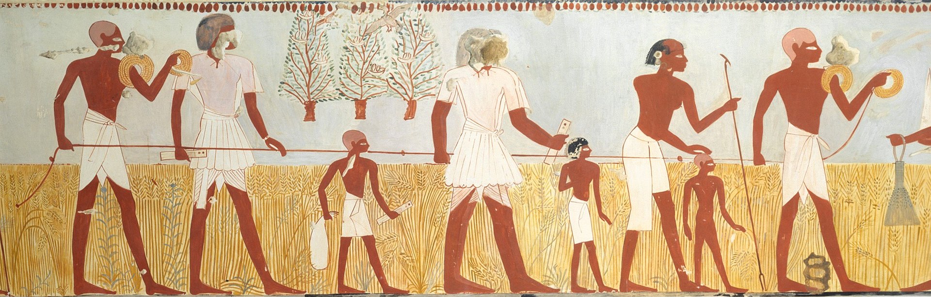
Maps on papyrus paper appeared in Egypt ~3,200 B.P.
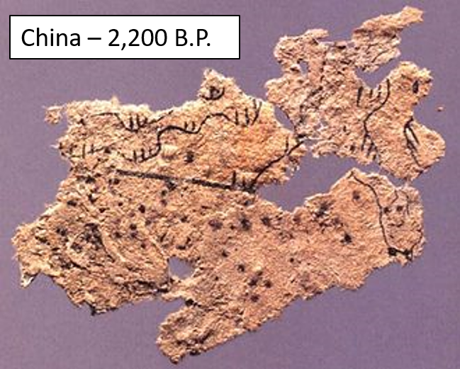
Paper and silk maps appeared in China ~2,200 B.P.
TopHat Question 2
The Ojibway people of the Great Lakes region created maps on scrolls of:
- Birch Bark
- Papyrus Paper
- Silk
- Animal Hide
Advent of Surveying
As societies coalesced, methods for the systematic collection of spatial information were developed.
- Objects needed to be drawn to scale
- Mastery of geometry and trigonometry
- Surveys were used to:
- Demarcate agricultural fields
- Construct buildings
- Plan settlements
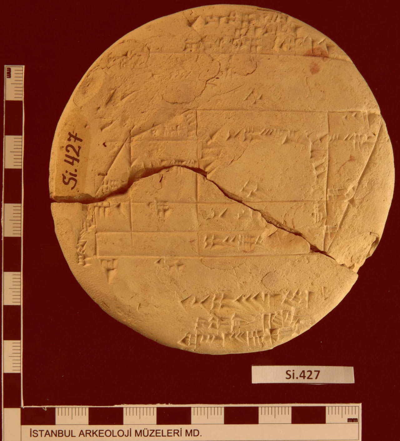
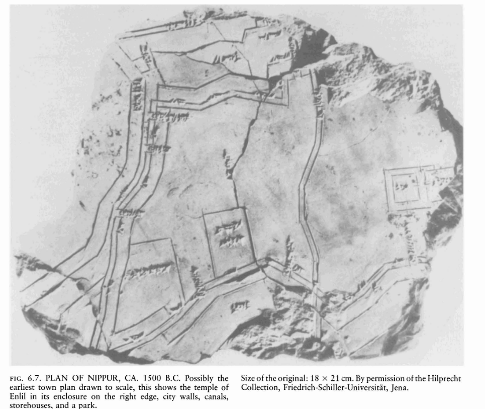
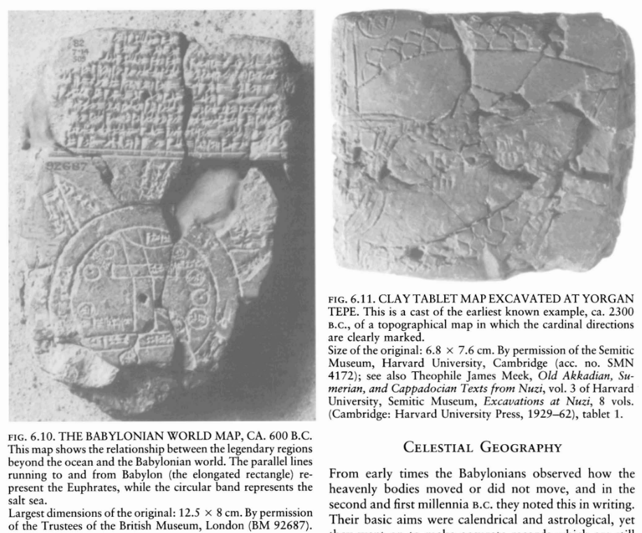
Urban Planning
Town plan of Nippur, Babylonia on a clay tablet. Possibly the earliest map drawn to scale 3500 B.P.
- Over small areas, maps could now "accurately" represent:
- Bearings (direction)
- Distances
- Sizes
Surveying Methods
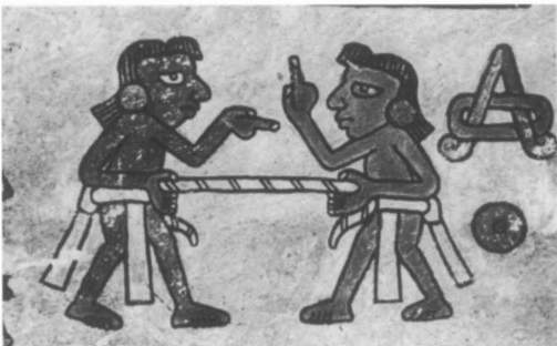
Rope stretching is the earliest technique to come about.
- It was labor intensive and only applicable for small areas
- Used for building monuments and agricultural surveys
Surveying Methods
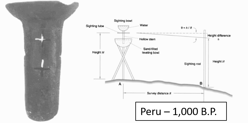
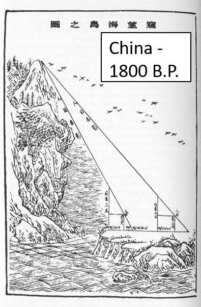
Line of sight methods allowed for surveying over greater distances and mapping larger areas.
Surveying Methods
Line of sight methods allowed for surveying over greater distances and mapping larger areas.
- Road networks could be constructed
- Distances between settlements could be approximated
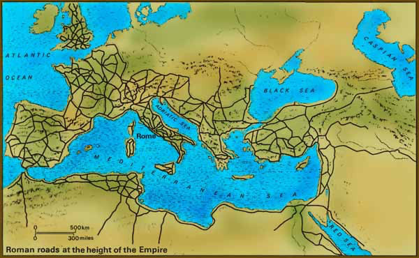
The Groma
The Roman Empire employed professional surveyors.
- Built a massive road network and created an Agricultural land registry
- They used the groma
- Precursor of the modern theodolite
The Compass
Lodestones are naturally occurring magnetic minerals. They were used to make compasses by the Olmec civilization (3000 B.P.).
- Oriented buildings and cities
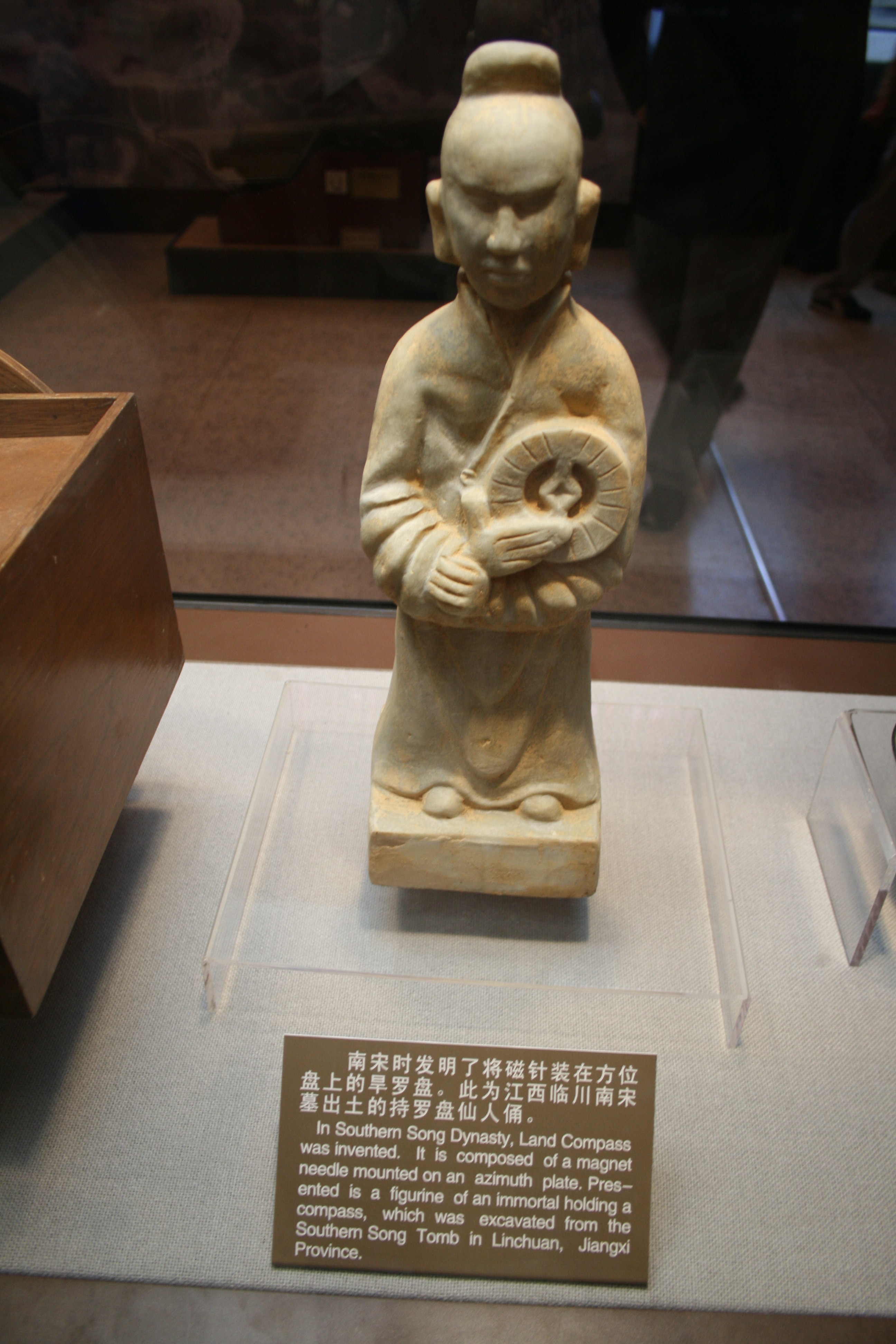
The Compass
Separately developed by the Han Dynasty ~2200 B.P.
- Initially used for orienting buildings
- Applied to marine navigation in China during the Song Dynasty ~ 1000 B.P.
- Reached Europe around 800 B.P.
- Spurred on the "Age of Exploration"
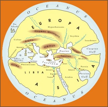
Exploration Spurred Cartographic Advances
Trade and travel expanded conceptualizations of what the world was.
- Greeks built on knowledge of the Egyptians & Mesopotamians
- Maps became more complex and "complete"
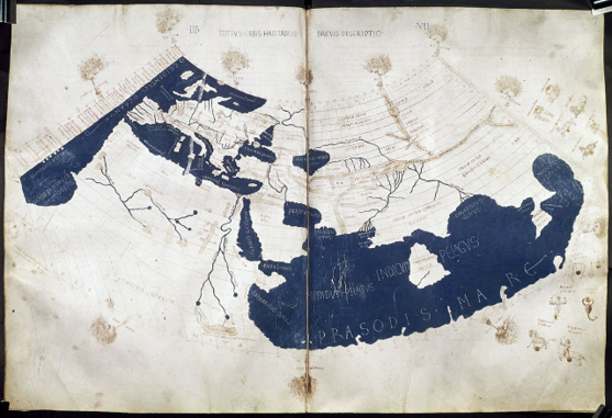
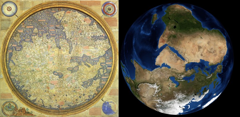
Ptolemy’s Geographia
The first known Atlas (1850 B.P.).
- 8 volume GIS prototype with an index of place names and projected maps
- Accounted for earth's curvature but underestimated size
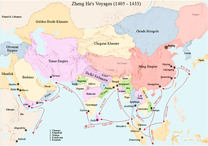
Chinese Exploration
Advances in maritime technology, including the compass led to a wave of exploration.
- Culminated in the Ming Dynasty Treasure Voyages
- By 600 B.P., they had mapped most of South & East Asia, East Africa, Indonesia & Australia
- May have even visited the west coast of North America!
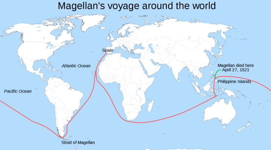
Spread of Information
Chinese and Islamic mariners brought technology westward.
- By 550 BP. Europeans had the compass
Spurred on the "Age of Discovery"
- European perspectives came to dominate the cartographic world
The Mercator Projection
Revolutionized navigation and cartography.
- Follow constant bearing and reach any location on earth
- Still used today (e.g. Google Maps)
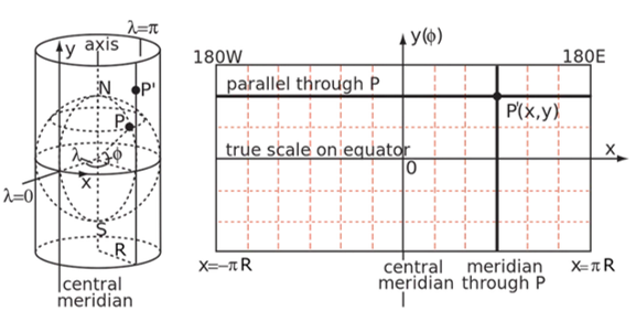
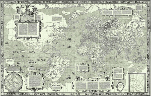
The Mercator Projection
The projection is problematic because it severely distorts the true size of some regions.
- Influences perceptions of high latitudes vs. equatorial regions
- We'll discuss more about why this is in Module 2

TopHat Question 3
This Mercator projection revolutionized navigation because you could use it to navigate anywhere in the world by following a:
- Line of sight
- Constant bearing
- Sea bird
- Great circle
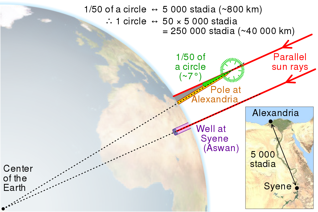
Spatial Analysis
As our representation of space became more accurate and precise, our ability to make spatial inferences expanded as well.
- As part of the Module 1 Lab we'll recreate an example from history using modern methods.
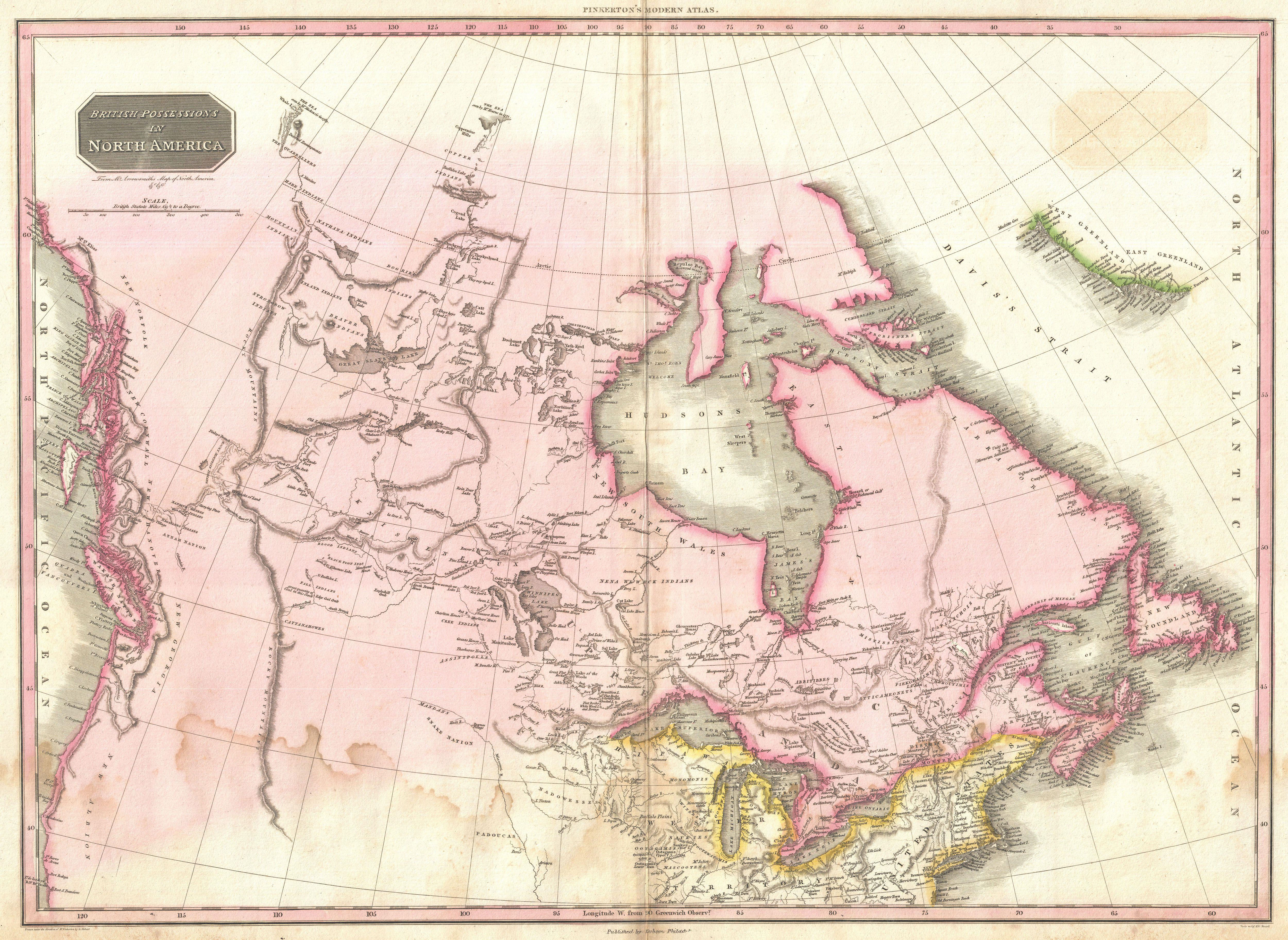
Canadian Context
Cartography facilitated colonialism and territorial expansion throughout Canadian history.
- The British and Canadian governments conducted surveys to map out resources
- Treated the land as a "blank canvas"
Canadian Context
Canada’s first scientific agency, founded in 1842. The GSC mapped resources and promoted expansion.
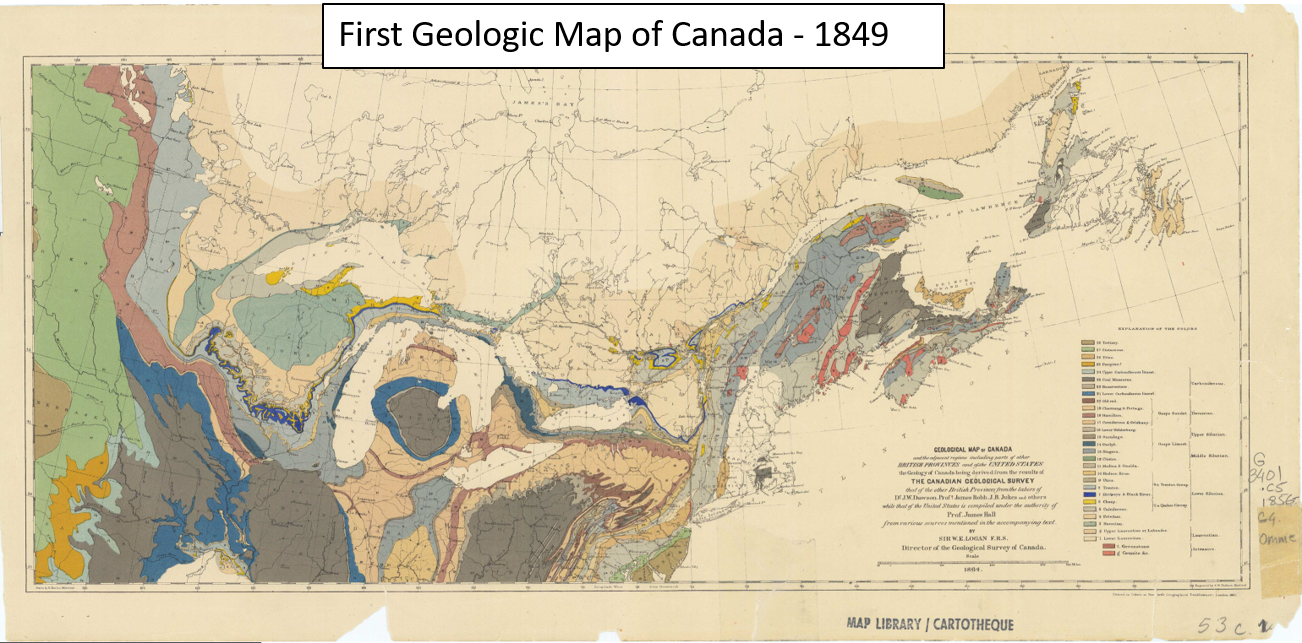
The government used GSC maps to identify and "claim" valuable territories.
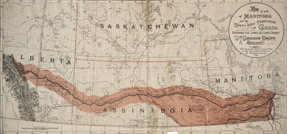
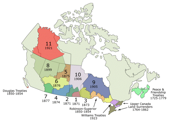
Numbered Treaties
Building on GSC Surveys, the government "negotiated" the numbered treaties.
- Cited survey maps as evidence of their "sovereignty"
- The RCMP were created to enforce treaties and displace Indigenous people
Countering Colonialism
The lands that comprise Canada have been inhabited for thousands of years and have histories that stretch back well before the colonial era.
- Many colonial mapping efforts were centered on erasing Indigenous peoples and their histories
- One way they accomplished this was through the use of place names

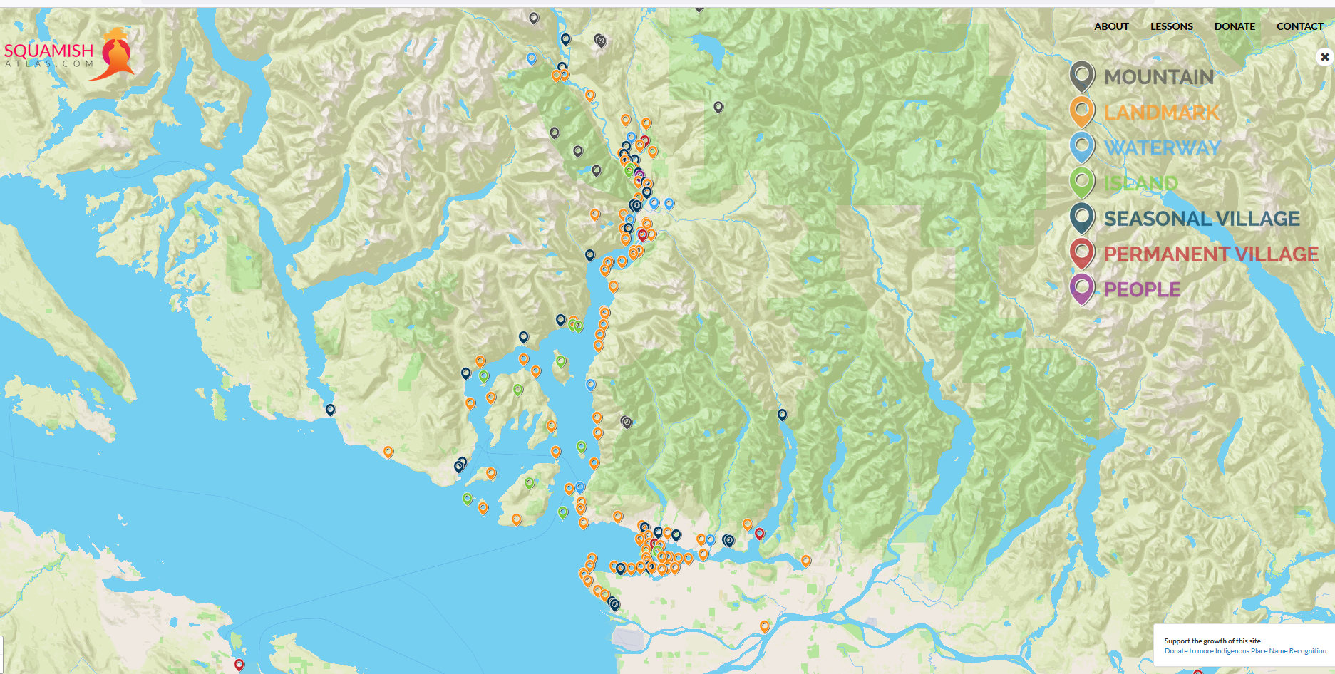
Ch'ich'iyuy is a Skwxwú7mesh word that translates to "Twins"
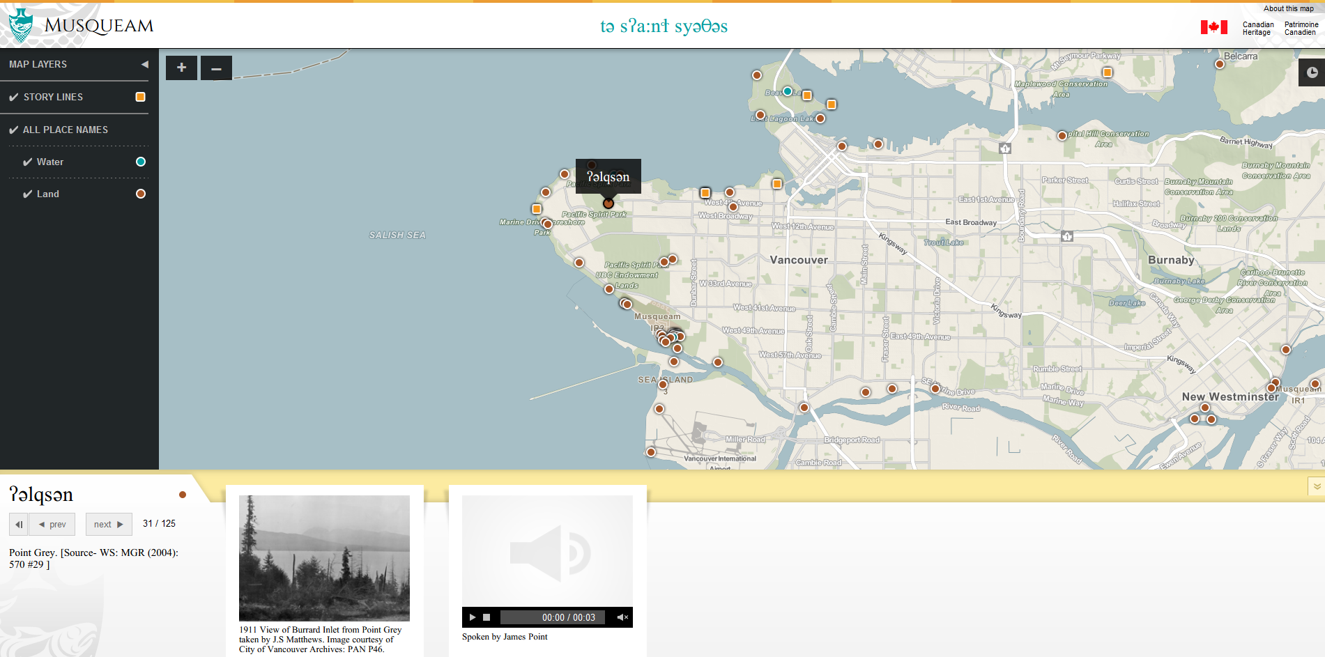
Learning Place Names
The Skwxwú7mesh Atlas is a great resource for learning about Skwxwú7mesh Place Names.
The xʷməθkʷəy̓əm nation has put together a great resource for as well!
Canada Land Inventory
Mapped suitability of lands for: Agriculture, forestry, recreation and wildlife.
- Original maps can be found here
- The first operational GIS
- Digital geographic database
- Advances in spatial analysis
Commercial Development
Following the CLI, a number of commercial software companies began developing GIS applications.
- Hardware improvements made the technology more accessible
- Mapping Display and Analysis System (MIDAS)
- First desktop GIS released in 1986
TopHat Question 4
The Canada Land Inventory led to the creation of the first digital
- Atlas
- Spatial Analysis Method
- Database
- Geographic Information System