Proliferation of GIS
GIS has become a powerful, widely used tool for GIS in recent decades.
Table of contents
Proprietary GIS Software
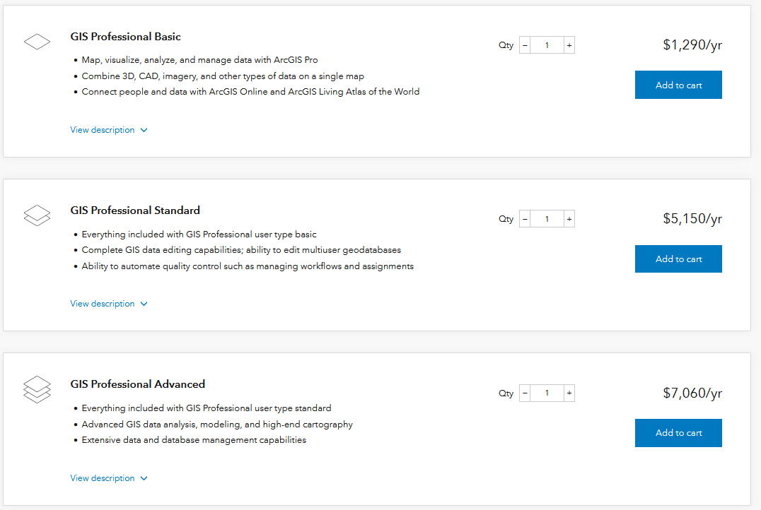
GIS is very much rooted in capitalism and the capitalist enterprise. Consequently many of the initial developments in GIS were by for profit companies. For example, ESRI is a leading producer of GIS software. They make ArcGIS Pro, the software package we will be working with most in this class.
Proprietary software requires users to purchase a license in order to gain access and restricts access to source code, meaning users have no right to view or edit source code (inner workings of a program). Common examples of proprietary technology include:
- Operating Systems: Windows OS, Mac OS, IOS
- Programming Languages: MATLAB, VBScript
- Software Packages: Microsoft Office (Word, Excel, Power Point etc.), Adobe Illustrator, IOS, ArcMap
Proprietary software licenses are often very expensive. They pose a significant barrier to access for uses that aren’t affiliated with large institutions.
ArcGIS Pro
Open Source GIS
There are alternatives! Open source software packages have proliferated in recent years and are a viable alternative to the traditional options. The the internet has connected like-minded developers and allowed for collaboration across the globe.
Open Source software is free to use, published under an open copyright license. Users have the right to view, edit, and distribute the source code. Common examples of open source technology include:
- Operating Systems: Linux OS, Android
- Programming Languages: Python, R, Java, etc.
- Software Packages: Libre Office (Writer, Calc, Impress, etc.), Ink Scape, QGIS
Open source software is more accessible because its free to download and use.
QGIS
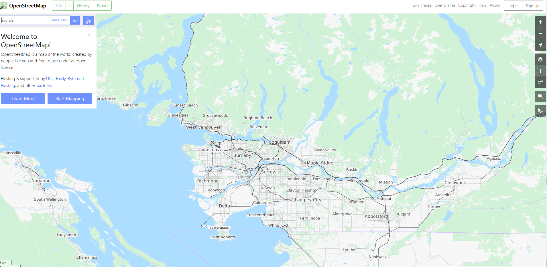
Open Street Maps
Open Street Maps is a freely available public database of geospatial information.
Programming Languages
Programming languages like Python and JavaScript can be used to conduct a variety of geospatial analysis and make webmaps. I created the map below using JavaScript. I’ll talk a bit more about these methods later on in the term.
Webmap for navigating to UBC micromet field sites.
Fremium Services
Companies like mapbox and google provide some geospatial services that are “free” to a point. For example, Google earth engine provides its cloud based computational capabilities to non-commercial users free of charge.
Tophat Questions
1
Which term describes freely accessible software that can be accessed, edited, and distributed by anyone?
- Proprietary
- Open Source
- Fremium
2
ArcGIS Pro is a proprietary software package. It is created and maintained by a private company and requires users to purchase a license to access it.
- True
- False